
Image: 2009 Victorian bushfires map 10 February annotated
No higher resolution available.
2009_Victorian_bushfires_map_10_February_annotated.JPG (791 × 558 pixels, file size: 42 KB, MIME type: image/jpeg)
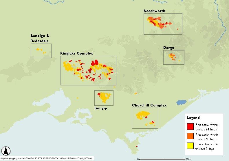
Description: Selected imagery from the NASA Fire Information for Resource Management System (FIRMS) project, generated by FIRMS' Web Fire Mapper (ArcIMS). The area shown is the eastern part of the Australian state of Victoria, as at 10 February 2009, 12:38pm local time (AEDT), showing the effects of the 2009 Victorian bushfires. Annotated version.
Title: 2009 Victorian bushfires map 10 February annotated
Credit: NASA Fire Information for Resource Management System (FIRMS)
Author: Automatically generated imagery from the FIRMS Web Fire Mapper (ArcIMS).
Usage Terms: Public domain
License: Public domain
Attribution Required?: No
Image usage
The following page links to this image:

All content from Kiddle encyclopedia articles (including the article images and facts) can be freely used under Attribution-ShareAlike license, unless stated otherwise.