
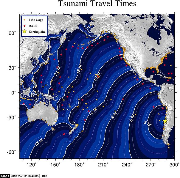
Image: 2010 Pichilemu earthquake - tsunami travel time map

Description: A strong earthquake with a moment magnitude of 6.9 (USGS magnitude) occurred at 11:39:44 UTC 11 March 2010 (day 070) and was located 85 miles/140 km SSW of Valparaiso, Chile (34.259S, 71.929W, 6.8mi/11.0km depth--USGS location). This earthquake produced a tsunami that was recorded at tide gages monitored at the Tsunami Warning Centers. Many observatories provide data to the centers; such as the NOAA National Ocean Service, the U. of Hawaii Sea Level Center, the Chilean Navy, and the National Tidal Facility in Australia among others. Click on the site name to see a graph of the tsunami, when available. Listed wave heights are maximum amplitude in cm (above sea level). Observed Arrival time is the actual tsunami arrival time in UTC on gages where it could be determined. The Computed Arrival time is the estimated time of arrival computed at the National Tsunami Warning Center (NTWC) based on the origin time and location. The Sample Interval column shows the time between samples.
Title: 2010 Pichilemu earthquake - tsunami travel time map
Credit: http://wcatwc.arh.noaa.gov/previous.events/3-11-10-Chile/Tsunami-03-11-10.htm
Author: NOAA
Usage Terms: Public domain
License: Public domain
Attribution Required?: No
Image usage
The following 2 pages link to this image:
