
Image: 2013 Alberta floods rainfall
Size of this preview: 564 × 600 pixels. Other resolutions: 226 × 240 pixels | 1,919 × 2,041 pixels.
Original image (1,919 × 2,041 pixels, file size: 218 KB, MIME type: image/png)
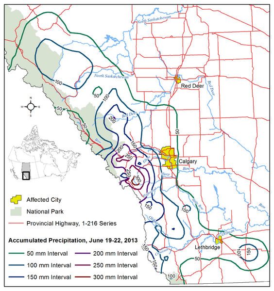
Description: Accumulated precipitation contour map of central and southern Alberta rainfall event occurring June 19-22, 2013 that triggered the 2013 Alberta floods, derived from this Precipitation Map (June 19-22, 2013) published by Alberta Environment and Sustainable Resource Development
Author: Hwy43
Usage Terms: Creative Commons Attribution-Share Alike 3.0
License: CC-BY-SA-3.0
License Link: http://creativecommons.org/licenses/by-sa/3.0/
Attribution Required?: Yes
Image usage
The following page links to this image:

All content from Kiddle encyclopedia articles (including the article images and facts) can be freely used under Attribution-ShareAlike license, unless stated otherwise.