
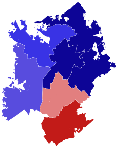
Image: 2022 Charlotte City Council elections results map

Size of this PNG preview of this SVG file: 480 × 600 pixels. Other resolution: 192 × 240 pixels.
Original image (SVG file, nominally 581 × 726 pixels, file size: 348 KB)
Description: Election Data Source: https://er.ncsbe.gov/?election_dt=07/26/2022&county_id=60&office=LOC&contest=0 City Border Shapefile Source: http://maps.co.mecklenburg.nc.us/openmapping/data.html?search=Annexation%20History City Council District Borders Shapefile Source: https://data.charlottenc.gov/datasets/council-districts/explore
Title: 2022 Charlotte City Council elections results map
Credit: Own work
Author: LandonExists
Usage Terms: Creative Commons Attribution-Share Alike 4.0
License: CC BY-SA 4.0
License Link: https://creativecommons.org/licenses/by-sa/4.0
Attribution Required?: Yes
Image usage
The following page links to this image:

All content from Kiddle encyclopedia articles (including the article images and facts) can be freely used under Attribution-ShareAlike license, unless stated otherwise.