
Image: 506-Castile 1210
No higher resolution available.
506-Castile_1210.png (474 × 506 pixels, file size: 138 KB, MIME type: image/png)
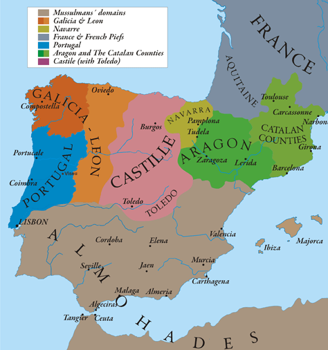
Description: This map show Al-Andalus (Almohades) and European Christian kingdoms. 12th-13th centuries. It´s made from "The Historical Atlas by William R. Shepherd, 1926".
Title: 506-Castile 1210
Credit: Own work
Author: Alexandre Vigo
Permission: Texas University
Usage Terms: Creative Commons Attribution-Share Alike 3.0
License: CC BY-SA 3.0
License Link: http://creativecommons.org/licenses/by-sa/3.0
Attribution Required?: Yes
Image usage
The following 2 pages link to this image:

All content from Kiddle encyclopedia articles (including the article images and facts) can be freely used under Attribution-ShareAlike license, unless stated otherwise.