Image: ADEN DISTRICS MAP-02-02

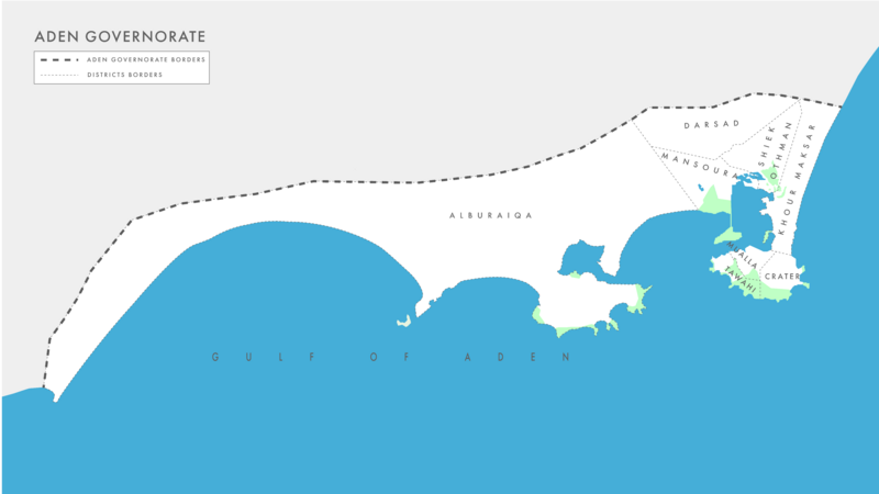
Description: This map showcases the districts within the city of Aden, located in South Yemen. Aden is a major port city situated in the southern part of the country, and it is divided into several administrative districts. The map uses a consistent color scheme to represent the districts, allowing for easy differentiation. However, to delineate the district boundaries, a dashed and thin line style is employed, providing a clear visual distinction between neighboring districts. Additionally, a bold and solid line style is used to outline the border of the governorate encompassing Aden, highlighting its administrative boundary. This map serves as a valuable reference to comprehend the distribution of districts within Aden and the broader governance structure of the region.
Title: ADEN DISTRICS MAP-02-02
Credit: Own work
Author: L'Hommedusud
Usage Terms: Creative Commons Attribution-Share Alike 4.0
License: CC BY-SA 4.0
License Link: https://creativecommons.org/licenses/by-sa/4.0
Attribution Required?: Yes
Image usage
The following page links to this image:

