
Image: A New and Accurate Map of Africa. Drawn from the best & most approved Modern Maps and Charts and regulated by Astronomical Observations by Eman Bowen CTASC
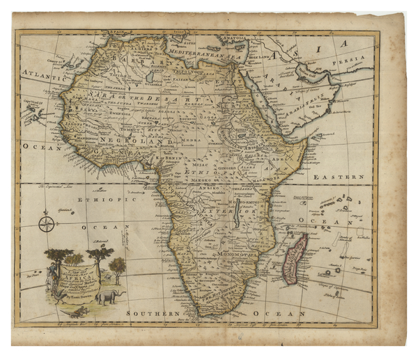
Description: Map of the continent of Africa from the atlas A complete system of geography, published in 1760. Countries, kingdoms, deserts, islands, and bodies of water are labelled. The Mediterranean Sea, Arabia, and some of Persia can be seen. A cartouche showing people, animals and trees can be seen in the lower left.
Title: A New and Accurate Map of Africa. Drawn from the best & most approved Modern Maps and Charts and regulated by Astronomical Observations by Eman Bowen
Credit: York University Libraries, Clara Thomas Archives & Special Collections, Historical map collection, HMC0018. http://digital.library.yorku.ca/islandora/object/yul:1153583
Author: Emanuel Bowen
Usage Terms: Public domain
License: Public domain
Attribution Required?: No
Image usage
The following page links to this image:
