
Image: A map of Canaan (8343807206)
Size of this preview: 735 × 599 pixels. Other resolutions: 294 × 240 pixels | 7,062 × 5,759 pixels.
Original image (7,062 × 5,759 pixels, file size: 38.43 MB, MIME type: image/jpeg)
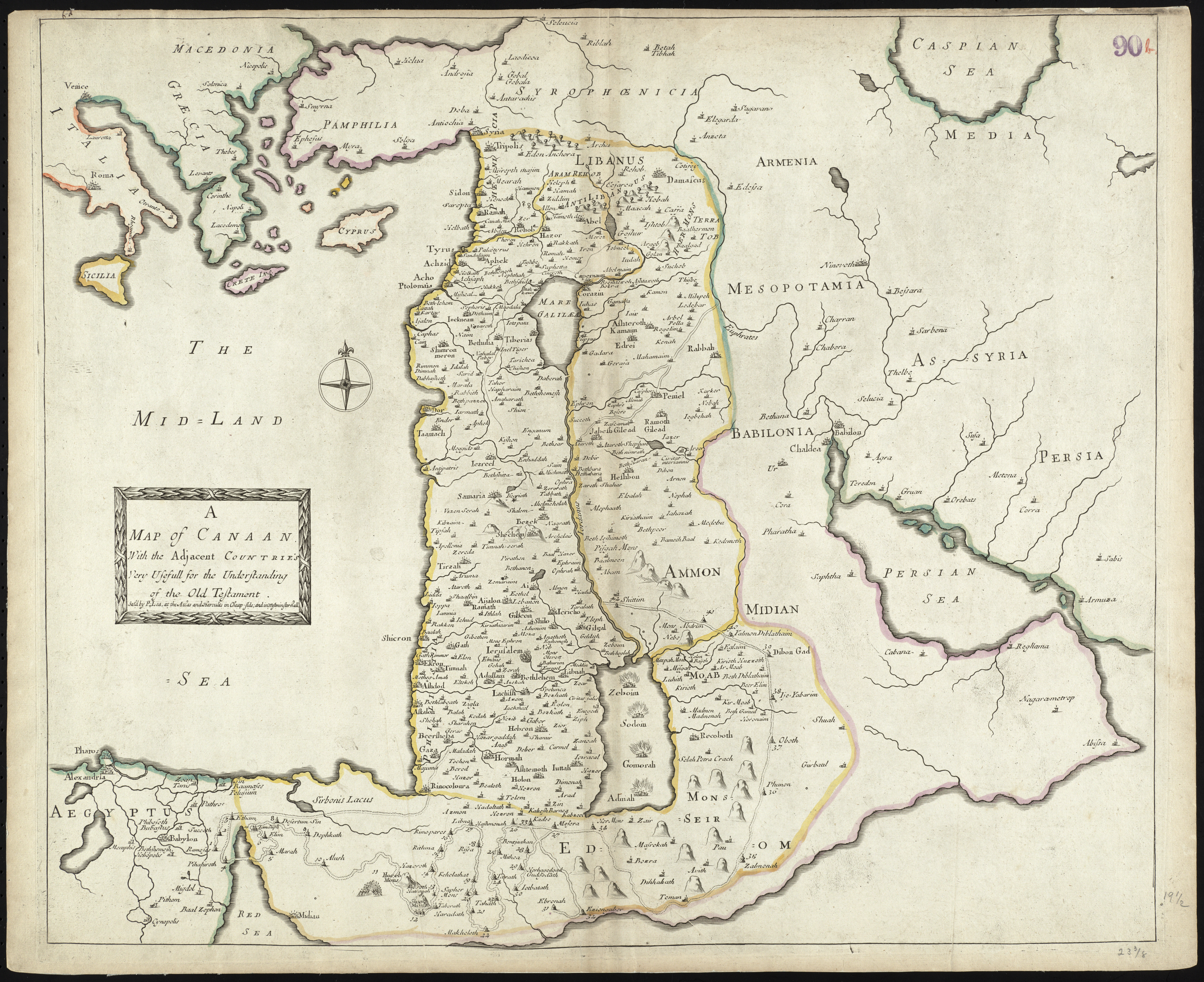
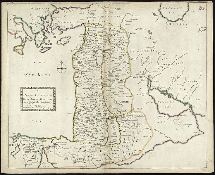
Description: Zoom into this map at maps.bpl.org. Author: Lea, Philip Publisher: Lea, Philip Date: 1692 Location: Holy Land, Israel, Palestine Dimensions: 51 x 60 cm. Scale: Scale not given Call Number: G1015 .C65 1630
Title: A map of Canaan (8343807206)
Credit: A map of Canaan
Author: http://maps.bpl.org
Usage Terms: Creative Commons Attribution 2.0
License: CC BY 2.0
License Link: http://creativecommons.org/licenses/by/2.0
Attribution Required?: Yes
Image usage

All content from Kiddle encyclopedia articles (including the article images and facts) can be freely used under Attribution-ShareAlike license, unless stated otherwise.
.jpg)