
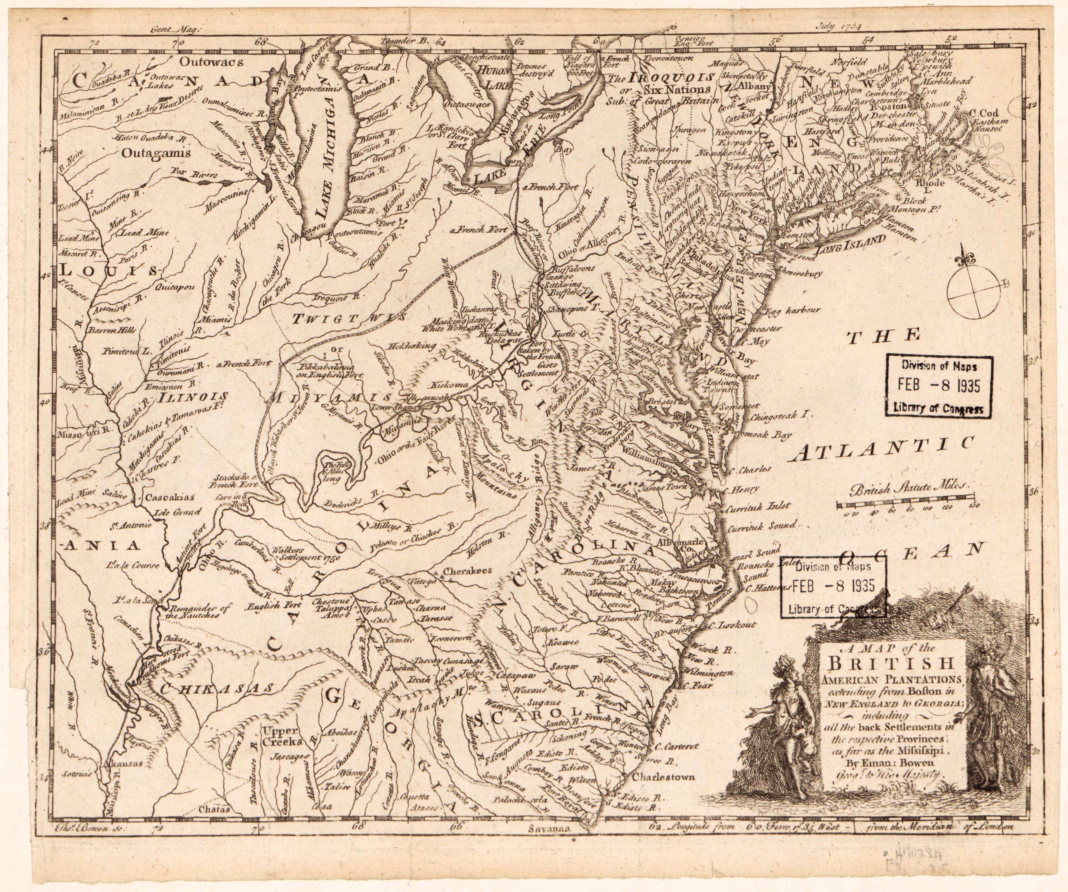
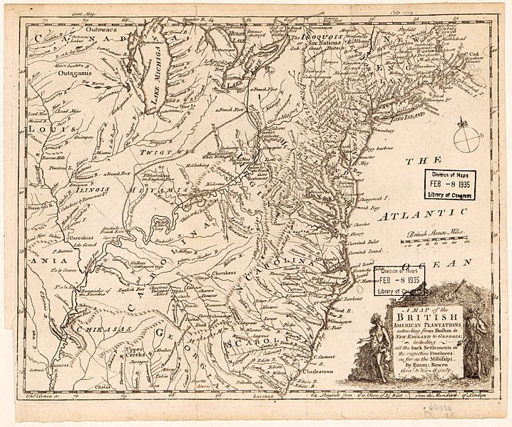
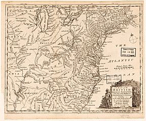
Image: A map of the British American plantations, extending from Boston in New England to Georgia - including all the back settlements in the respective provinces as far as the Mississipi LOC 2017585923
Description: Relief shown pictorially. Shows area east of the Mississippi from Niagara Falls to Port Royal, S.C. Includes illustrated cartouche. Prime meridian: Ferro. From the Gentlemen's Magazine, vol. 24, July 1754. LC copy mounted on paper mounted on cloth. LC Maps of North America, 1750-1789, 708 Available also through the Library of Congress Web site as a raster image.
Title: A map of the British American plantations, extending from Boston in New England to Georgia - including all the back settlements in the respective provinces as far as the Mississipi LOC 2017585923
Credit: https://www.loc.gov/item/2017585923/
Author: Bowen, Emanuel; Bowen, Thomas
Permission: This map is available from the United States Library of Congress's Geography & Map Division under the digital ID g3300.ar070800. This tag does not indicate the copyright status of the attached work. A normal copyright tag is still required. See Commons:Licensing for more information.
Usage Terms: Public domain
License: Public domain
Attribution Required?: No
Image usage
The following 3 pages link to this image:
