
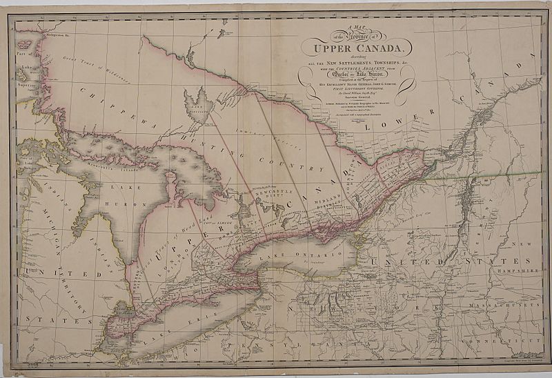
Image: A map of the province of Upper Canada describing all the settlements and townships, 1818

Size of this preview: 800 × 548 pixels. Other resolutions: 320 × 219 pixels | 1,920 × 1,316 pixels.
Original image (1,920 × 1,316 pixels, file size: 944 KB, MIME type: image/jpeg)
Description: This image is available from the Toronto Public Library
Title: A map of the province of Upper Canada describing all the settlements and townships, 1818
Credit: A map of the province of Upper Canada describing all the settlements and townships &c. with the countries adjacent from Quebec to Lake Huron at the Toronto Public Library
Author: David William Smith
Usage Terms: Public domain
License: Public domain
Attribution Required?: No
Image usage
The following 2 pages link to this image:

All content from Kiddle encyclopedia articles (including the article images and facts) can be freely used under Attribution-ShareAlike license, unless stated otherwise.