
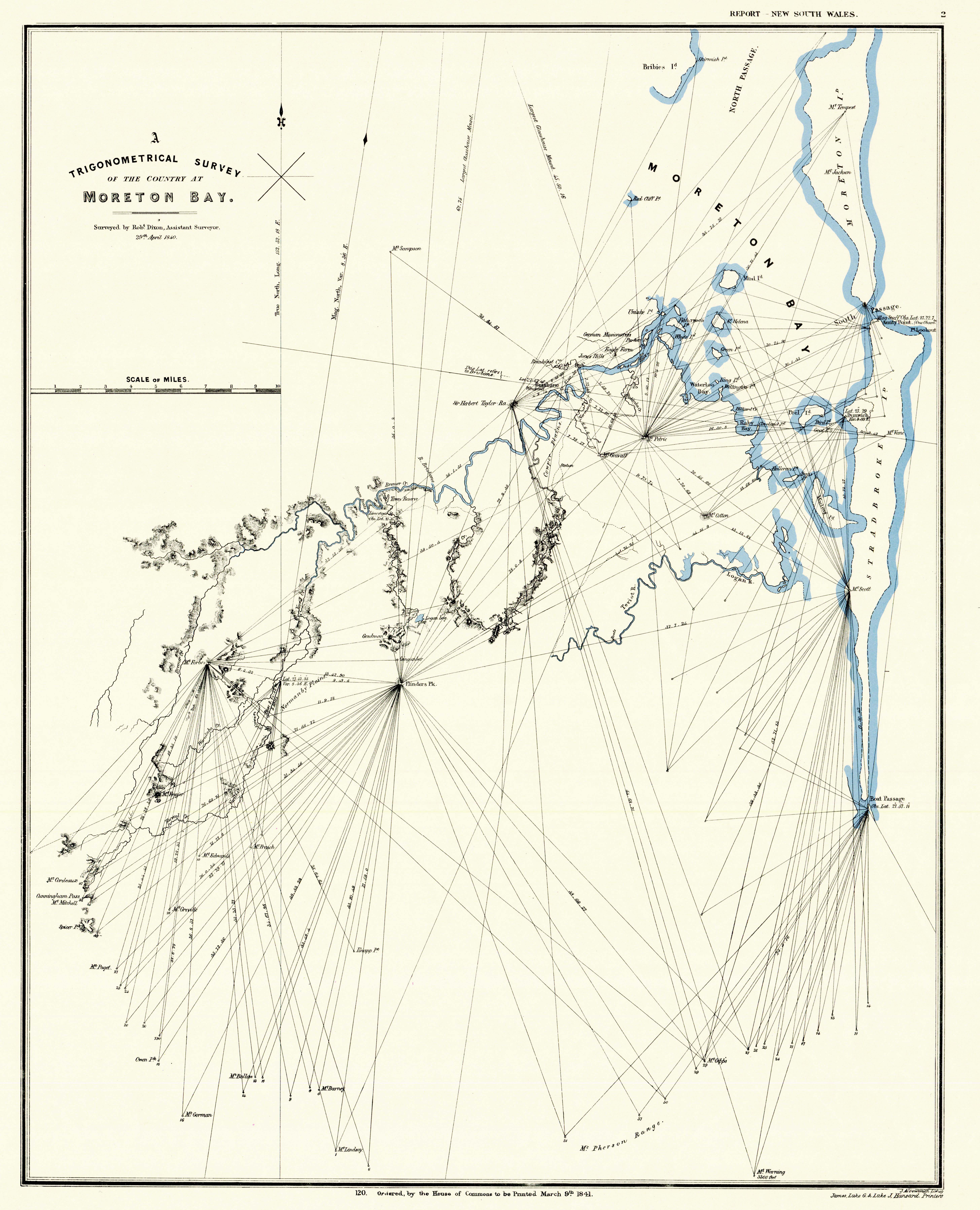
Image: A map showing the Trigonometrical Survey of the Country at Moreton Bay surveyed by Robert Dixon Assistant Surveyor 29th April 1840
Size of this preview: 485 × 599 pixels. Other resolutions: 194 × 240 pixels | 5,824 × 7,191 pixels.
Original image (5,824 × 7,191 pixels, file size: 2.63 MB, MIME type: image/jpeg)
Description: A map showing the Trigonometrical Survey of the Country at Moreton Bay surveyed by Robert Dixon Assistant Surveyor 29th April 1840
Title: A map showing the Trigonometrical Survey of the Country at Moreton Bay surveyed by Robert Dixon Assistant Surveyor 29th April 1840
Credit: Error: title= and url= must be specified. Queensland Government (29 April 1840). Retrieved on 29 February 2020.
Author: Robert Dixon
Usage Terms: Public domain
License: Public domain
Attribution Required?: No
Image usage
The following page links to this image:

All content from Kiddle encyclopedia articles (including the article images and facts) can be freely used under Attribution-ShareAlike license, unless stated otherwise.