Stradbroke Island facts for kids
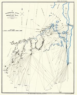
Stradbroke Island, also known as Minjerribah, was once a very large sand island. It formed much of the eastern side of Moreton Bay near Brisbane, Queensland. Today, the island is split into two separate islands: North Stradbroke Island and South Stradbroke Island. These two islands are separated by the Jumpinpin Channel.
In 2009, Stradbroke Island was recognized as one of Queensland's "Natural attractions." This was part of the Q150 celebrations, marking 150 years since Queensland became a separate colony.
Contents
Island's First People
Scientists have found proof that the Quandamooka people, an Aboriginal Australian group, lived on Stradbroke Island for at least 21,000 years. The island was a special meeting place for different Quandamooka groups, including the Nunukul and Goenpul people. In 1964, a study found 121 old living sites with signs of large wooden huts.
The Jandai language is one of the Australian Aboriginal languages spoken on Stradbroke Island. It is also known by names like Janday and Goenpul.
European Arrivals
There are old stories about a Spanish shipwreck from the 1600s near Stradbroke Island. People call it the Stradbroke Island Galleon. Aboriginal oral history also tells tales that might be about such an event. Some items found in the sand dunes include an English silver coin from 1597 and part of a 17th-century Spanish sword. However, there is no final proof yet.
Captain James Cook was the first European to record seeing the island in 1770. He named Point Lookout but did not land. The first recorded meeting between Europeans and the local Aboriginal people happened in 1803. This was when Matthew Flinders landed, looking for fresh water.
Later, in 1823, three shipwreck survivors named Thomas Pamphlett, Richard Parsons, and John Finnegan landed on Moreton Island. Local Aboriginal people then took them to Stradbroke Island. The Aboriginal people helped them, giving them food, shelter, and a canoe.
Early Settlements
The first European settlement on Stradbroke Island was at Amity Point in 1825. A pilot station was set up there to guide ships. Soon, people moved the main settlement to Dunwich. This new spot had better soil, fresh water, and a safer harbor.
Dunwich became a key stop for ships. Large ships would unload their goods there. Smaller boats would then carry the cargo over the sand bars of the Brisbane River to the Brisbane penal settlement. The Dunwich settlement was close to a big Aboriginal camp at Myora Spring. Europeans and Aboriginal people generally lived together peacefully. However, there were some difficult times as two very different cultures met.
Early attempts to farm on the island, especially growing cotton, led to conflicts with the local Ngugi tribe of the Quandamooka people. In March 1830, soldiers attacked a group of Ngugi people near a lagoon on Moreton Island. This was a very difficult event for the local Indigenous people.
In 1843, the first Catholic mission for Aboriginal people was started on Stradbroke Island. Archbishop Polding chose the site. But the mission did not succeed because of poor relations with local tribes and a lack of supplies. The missionaries left in 1847.
A quarantine station was built at the northern end of the island in July 1850. It was chosen because it was near shipping routes, isolated, and had fresh water.
Shipwreck and Reserve
On February 2, 1887, the ship Scottish Prince got stuck on the southern end of Stradbroke Island. Three tug boats tried to pull it free, but they failed. All the people on board were saved, but the ship broke apart. Its goods washed ashore. Parts of the wreck can still be found in shallow water about 500 meters offshore. It is a popular place for diving. Since 2013, sand has shifted, making more of the wreck visible.
Myora Mission was an Aboriginal reserve that operated from 1892. It was first run by a protection group and then by the Queensland Government. It closed in 1943.
How the Island Split
In September 1894, strong waves caused the ship Cambus Wallace to run aground. It got stuck at a narrow strip of land about halfway down the island. Efforts to save the ship, including setting off explosives, weakened the sand dunes. By 1896, storms and tides had created a permanent opening from Moreton Bay to the Coral Sea.
Now, the island is two separate islands, divided by the Jumpinpin Channel:
- North Stradbroke Island is the larger island. It is about 38 kilometers long and up to 11 kilometers wide.
- South Stradbroke Island is about 22 kilometers long and at most 2 kilometers wide.
North Stradbroke Island is more developed. It has three small towns: Dunwich, Amity Point, and Point Lookout. These towns offer places to stay, shops, and restaurants. It also has sealed roads.
South Stradbroke Island is less developed. It has several places for boats to anchor and campsites. There are also two main tourist resorts: Couran Cove and South Stradbroke Island Resort (Tipplers). There are almost no sealed roads on this island.
In Popular Culture
The 2015 novel Ghost Galleon by Errol Bishop is based on the legend of the Stradbroke Island Galleon. Bishop learned about the legend while working as a school principal on Macleay Island in Moreton Bay.
 | Janet Taylor Pickett |
 | Synthia Saint James |
 | Howardena Pindell |
 | Faith Ringgold |


