North Stradbroke Island facts for kids
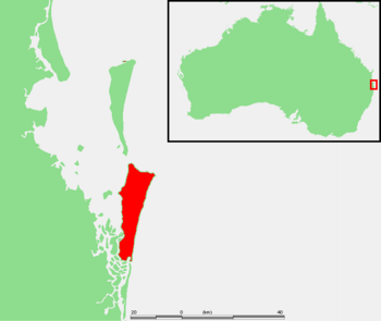
North Stradbroke Island (Jandai: Minjerribah), often called Straddie, is an island in Moreton Bay, Queensland, Australia. It's about 30 kilometers southeast of Brisbane. Originally, there was one large Stradbroke Island. But in 1896, a channel called Jumpinpin split it into North Stradbroke Island and South Stradbroke Island. The Quandamooka people are the traditional owners of North Stradbroke Island.
The island has four main areas: Dunwich, Amity, and Point Lookout are small towns. The rest of the island is simply called North Stradbroke Island. All these areas are part of Redland City.
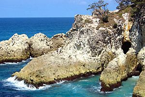
At 275.2 square kilometers, North Stradbroke Island is the second largest sand island in the world. It has three small towns, many lakes, and long beaches. There are also rocky areas at Point Lookout. Aboriginal people have lived on the island for a very long time. Tourism is a big and growing industry here. For over sixty years, sand mining has also been important. Today, tourism and mining are the island's main industries.
|
Native name:
Minjerribah
Nickname: Straddie
|
|
|---|---|
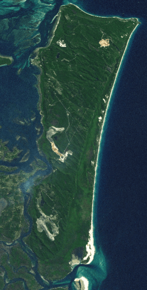
NASA World Wind Landsat montage
|
|
 |
|
| Geography | |
| Location | Moreton Bay |
| Coordinates | 27°35′S 153°28′E / 27.583°S 153.467°E |
| Area | 275.2 km2 (106.3 sq mi) |
| Length | 38 km (23.6 mi) |
| Width | 11 km (6.8 mi) |
| Highest elevation | 239 m (784 ft) |
| Administration | |
|
Australia
|
|
| State | Queensland |
| Region | South East Queensland |
| Metropolis | Brisbane |
| Local government area | Redland City |
| Demographics | |
| Population | 2026 (2011 census) |
| Ethnic groups | Quandamooka people |
Contents
Island Geography and Nature
North Stradbroke Island is the second largest sand island in the world. It works with South Stradbroke and Moreton Island to form a natural barrier. This barrier protects Moreton Bay from the Coral Sea.
The island is about 38 kilometers long and 11 kilometers wide. Its total area is around 275 square kilometers. The highest point on the island is 239 meters above sea level. The weather here is sub-tropical. Summers are warm and wet, and winters are mild. The island gets about 1587 millimeters of rain each year. The average highest temperature is 25 degrees Celsius.
In 2011, the island's population was 2026 people. Most lived in Dunwich (883), Point Lookout (678), and Amity (348). The number of people on the island grows a lot during holidays. You can only reach the island by car or passenger ferries from Cleveland.
There are three towns on the island. Dunwich is the biggest. It has a school, medical center, museum, and a university research station. Point Lookout is on the ocean side. It's the main place for tourists during holidays. The third town is Amity Point. It's smaller and a popular spot for fishing. Flinders Beach is a small group of holiday homes. It's on the main beach between Amity and Point Lookout.
The whole island is part of the Redland City local government area. It's part of Division 2. The two largest lakes are Brown Lake and Blue Lake. In January 2014, bushfires burned about 60% of the island's bushland. But the plants grew back later.
Island Beaches
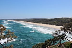
North Stradbroke Island has five main beaches. They are great for fishing, surfing, and swimming.
- Main Beach is 32 kilometers long and good for surfing.
- Cylinder Beach is a safe swimming beach with smaller waves.
- Home Beach is also popular for swimming.
- Frenchmans Beach/Deadmans Beach has rock pools but no lifeguards.
- Flinders Beach is good for swimming and beach camping.
Main Beach is also where you can find the Keyhole Track. This is a popular track for 4WD vehicles near Brisbane. The entrance is close to Point Lookout.
Lakes, Springs, and Wetlands
North Stradbroke Island has over 100 freshwater lakes and wetlands. It also has important underground water sources. Local communities and a sand mining company use this water. A lot of this underground water is also sent to the mainland. The island has more wetlands that have existed since the last ice age than anywhere else in mainland Australia.
We don't know much about how these wetlands depend on underground water. So, using more of this water is currently on hold. These important areas include freshwater and saltwater wetlands, mangrove forests, and paperbark trees. Many wetlands are homes for threatened birds that travel long distances. This includes 34 species listed by agreements like JAMBA and CAMBA.
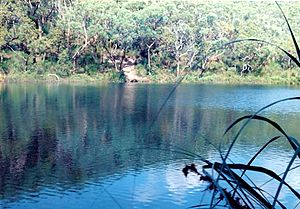
Blue Lake
Blue Lake is one of the island's largest lakes. It is protected within the Naree Budjong Djara National Park. This lake is very important to the Quandamooka people. It is fed by springs and has a steady water level. This means it has not changed much due to climate change. It looks much the same as it did 7,500 years ago. Blue Lake has been a safe place for freshwater plants and animals. With good care, the lake could stay this way for thousands of years.
Brown Lake
Brown Lake is a unique type of lake called a perched lake. It holds its water because of a layer of leaves on its bottom. This layer stops water from sinking into the ground. Brown Lake is also culturally important to the Quandamooka people.
Eighteen Mile Swamp
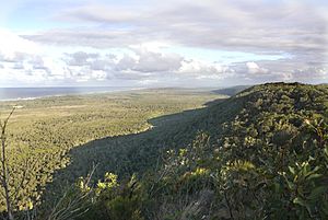
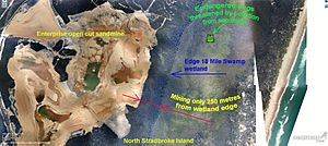
The Eighteen Mile Swamp is the largest of its kind in the world. It is a great example of a coastal freshwater swamp. It's special because of its large size and shape (very long and narrow). It covers 30 square kilometers. It is also quite young, formed between 500 and 6,000 years ago. On March 27, 2011, this area became a national park. It was named Naree Budjong Djara National Park, which means My Mother Earth. The Quandamooka people, who are the traditional owners, help manage it with the Queensland government. This wetland is very close to the large Enterprise Mine.
The Eighteen Mile Swamp is home to many rare and endangered species. This includes the vulnerable Cryptocarya foetida tree. This tree lives in the vine forests at the base of the high sand dunes. These high dunes on the west side of the swamp are great examples of long dunes. They move across North Stradbroke Island from southeast to northwest. This movement has created complex water systems with older dunes, some up to 300,000 years old. You don't see similar things on Moreton and Fraser Islands.
Myora Springs and Myora Creek Swamp
Myora Springs is a special wetland on the northwest side of North Stradbroke Island. It is very important to the Quandamooka people as a sacred meeting place. It is also a protected fish habitat. Myora Springs is known to be a key home for the vulnerable water mouse (Xeromys myoides) and the endangered swamp orchid (Phaius australis).
Lake Kounpee
Lake Kounpee is another perched lake. It was partly drained in 1987 after sand mining operations broke its waterproof layer. The mining company spent a lot of money trying to fix the damage. They now admit they cannot repair the lake. It changed from a clear freshwater lake to a reedy waterhole.
Other Lakes and Wetlands
Other perched lakes include Black Snake Lagoon, Ibis Lagoon, Welsby Lagoon, Native Companion Lagoon, and Tortoise Lagoon. These are all within the Naree Budjong Djara National Park. Amity Swamp was damaged in 1991 when a large amount of diesel spilled from a sand mining company. This spill was not reported until 1994. The mining company was never fined for these environmental problems.
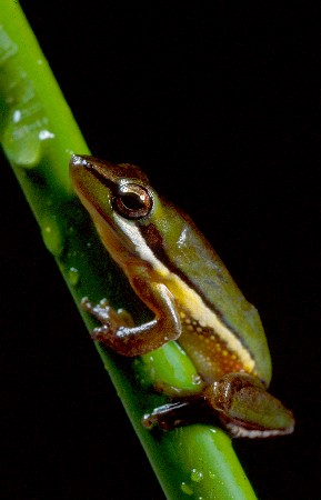
Flinders Swamp and its waterways are home to the rare acid frog (Litotia cooloolensis). This area also has homes for rare burrowing skinks (Anomalopus truncatus). The Keyholes are clear, freshwater lakes at the north end of the 18 Mile Swamp. They were popular for canoeing. However, the Yarraman Mine now operates close to these lakes. So, public access has been closed because it is a mining area.
Island Animals
North Stradbroke Island is home to many rare, vulnerable, endangered, and near-threatened animals.
Some examples include:
- Migratory wading birds: These include 34 species listed by international agreements like JAMBA and CAMBA.
- Wallum froglet (Crinia tinnula): These frogs live in many areas like Dunwich, Amity, Blue Lake, and Eighteen Mile Swamp.
- Cooloola sedge frog (Litoria cooloolensis): These frogs are found in places like Eighteen Mile Swamp, Brown Lake, and Blue Lake. The frogs on North Stradbroke Island might be a unique species. They are genetically different and have a different mating call.
- Nannoperca oxleyana (Oxleyan pygmy perch): There are two different groups of these fish on the island. They are found in very small numbers.
Island Plants
The island has 780 recorded plant species. 599 are native, and 181 were brought in. Of these, 14 species are threatened or near threatened. Two of these are found only on North Stradbroke Island.
Some examples include:
- Notophyll vine forest: These forests grow on the lower slopes of high dunes. They are home to rare and threatened plants like Cryptocarya foetida.
- Acacia baueri (Bauer's wattle): This vulnerable plant grows in sandy areas that are wet during certain seasons.
- Durringtonia paludosa (Durringtonia): This near-threatened plant is found in Myora Swamp and Eighteen Mile Swamp.
- Phaius australis (swamp orchid): This endangered orchid grows in Flinders Beach Wetlands, Myora, and Eighteen Mile Swamps.
- Thelypteris confluens (soft swamp fern): This vulnerable fern is found in permanently wet swamp areas.
- Blandifordia grandiflora (Christmas bells): This plant is endangered.
- Eleocarpus difformis (underwater spikerush): This endangered plant is found only on the island.
- Olearia hygrophila (swamp daisy): This endangered plant is also found only on the island.
- Phaius bernaysi (swamp orchid): This endangered orchid is likely a yellow version of P. australis.
Island History
North Stradbroke Island has the earliest signs of human life in southeast Queensland. The Aboriginal name for the island is Minjerribah, meaning "island in the sun." The first European to visit was Matthew Flinders in 1802. He was looking for fresh water. He was impressed by the health and kindness of the Aboriginal people.
Local stories say there was earlier contact with non-Indigenous people. Two survivors from a shipwreck walked into an Aboriginal camp. One was named Juan and the other Woonunga. In 1890, a local family member said the ship's remains were still visible in the 18 Mile Swamp. This led to a local legend about a Spanish or Portuguese shipwreck in the swamp.
In 1823, three shipwrecked sailors from Sydney, Thomas Pamphlett, John Finnegan, and Richard Parsons, stayed on the island. The local Aboriginal people gave them food, shelter, and a canoe. Their stories made people interested in the Moreton Bay area. In 1827, Governor Ralph Darling named the island Stradbroke and the town Dunwich. These names honored Captain Henry John Rous, whose family had these titles.
A mission was started at Moongalba by priests in 1843, but it did not last long. Myora Mission was set up as a mission station in 1892 at Moongalba. It became an Aboriginal reserve and a "reform school" in 1896. It was used as a source of cheap labor and closed in 1943. Local Aboriginal people worked at the Dunwich Benevolent Asylum. They were the first Aboriginal people in Australia to get equal wages. This happened in 1944, after a 25-year effort. The Asylum closed soon after.
In September 1894, a ship called Cambus Wallace ran aground. It was at a narrow strip of land about halfway down the island. Salvage work, including blowing up some explosives, weakened the sand dunes. By 1896, storms and tides created a permanent opening. This formed North and South Stradbroke Islands, separated by the Jumpinpin Channel.
North Stradbroke Island's most famous local was Oodgeroo Noonuccal, also known as Kath Walker. She was an Aboriginal poet and fought for native rights. She helped create a major agreement in 1997. This agreement was between the local government and the Aboriginal people. It recognized their rights over the island and parts of Moreton Bay.
Indigenous People
The Quandamooka people are an Aboriginal Australian group. They include the Noonuccal, Goenpul, and Ngugi tribes. Quandamooka is the Aboriginal name for Moreton Bay. The Quandamooka people have always lived on North Stradbroke Island. They traditionally moved between different settlements and lived off the land.
In July 2011, the Quandamooka people won a 16-year legal fight. Their Native Title claim was recognized. This means their rights to land and water on and around North Stradbroke Island were officially accepted. The Quandamooka People's native title covers most of North Stradbroke Island, Peel Island, Goat Island, Bird Island, Stingaree Island, and Crab Island. It also covers the water around Moreton Bay.
In December 2021, people were not allowed to camp on the island unless they were fully vaccinated against COVID-19. This rule was put in place to protect the Indigenous elders living on the island.
Sand Mining on the Island
History of Mining
In 1949, a company called Australian Consolidated Industries (ACI) started sand mining on North Stradbroke Island. Consolidated Rutile Limited (CRL) took over these operations in 1966. CRL mined for mineral sands. From 2001, a different company, Sibelco Australia, operated a silica sand mine. In 1998, Iluka Resources Limited bought most of CRL. Then, in 2009, Unimin Australia Limited bought Iluka Resources' share in CRL. In December 2010, the company changed its name to Sibelco Australia. Iluka Resources still sells mineral sands from Sibelco Australia's mines overseas.
Mining began on the beaches in the 1950s. This caused little harm to the environment at first. But as mining moved inland in the late 1960s and grew in the 1970s, its impact on the island's nature increased. CRL started dredge-mining on the island's high dunes. Dredge mining involves flattening high dunes and removing plants to create a pond. This greatly changed the island's landscape. The dredge constantly moves, leaving behind sand. Even though the mined dunes are replanted, the original natural environment cannot be fully replaced.
In the 1970s, there was talk of developing the island for homes. In 1970, the Queensland government even considered building a bridge from the mainland. The government also suggested a big redevelopment in the mid-1980s. This would have made the island's population ten times larger. However, after environmental groups raised concerns, the idea was dropped in 1986.
In 1991, the Australian Government and mining companies tried to agree. They wanted to turn some mining areas into a national park. Half of North Stradbroke Island was to become a national park. In return, mining would be allowed to continue in certain areas. However, this agreement was never signed.
Sibelco Australia operated three sand mining sites on the island: Enterprise (the largest), Vance, and Yarraman.
Mineral sands and silica sands were mined from the surface at Vance mine, near Dunwich. Rutile, zircon, and ilmenite were dredged from the Enterprise Mine, southeast of Dunwich. Enterprise was the largest mine. It was close to the Eighteen Mile Swamp. There was a buffer zone between the mine and the wetlands. Environmental groups worried these buffer zones were too small to protect the wetlands.
In 2009, about 500,000 tonnes of minerals were produced by mining about 50 million tonnes of sand. Sibelco Australia produced 500,000 to 600,000 tonnes of sand each year. This was about one percent of the island's total sand. The silica was mainly used to make glass and in digital devices like iPads. The mineral sands were used in paints, plastics, metals, cosmetics, and medical devices. Most of these were sold to China.
Environmental Concerns and Mine Closures
In 1991, a large amount of diesel spilled from a sand mining company into Amity wetlands. This was not reported until 1994. The company was never fined for these environmental incidents. In 2008, the company received an award for its environmental practices. At that time, two-thirds of the island was covered by mining leases.
In 2009, it became known that the mining leases for the Enterprise and Yarraman Mines had expired. This led to an announcement in June 2010. The Premier said sand mining on the island would gradually stop by 2027. The mined land and wetlands would become a national park, eventually covering 80% of the island. This plan depended on renewing the expired mining leases.
In another legal case, the High Court of Australia ruled against Sibelco in June 2011. Sibelco wanted to sell sand to construction companies. The court upheld the Redland City Council's decision to deny this.
The public discussed what would happen to the island's economy. Environmental groups argued that mining should end sooner. They said 2027 was already the expected end date for the minerals. Sibelco Australia wanted to keep mining until 2027. A report they ordered predicted that closing mining earlier would cause problems. It said ferry costs, electricity, and fuel prices would rise. It also predicted a 30% drop in jobs on the island.
The largest expired mining lease, ML1117, included the Enterprise dredge mine. Parts of this area were important for conservation. They were included in the national estate and the Moreton Bay Ramsar protected wetland. All of it was planned to become part of a national park. Environmental groups argued that more mining would be wrong given these future land uses. They believed the lease should not be renewed.
In response, on March 22, 2011, the Premier announced that the Enterprise Mine would operate until 2019. The Yarraman mine would operate until 2015, and the silica mine (Vance) until 2025. The Queensland government passed a new law, the Stradbroke Island Sustainability and Protection Act 2011. This law renewed the Enterprise Mine lease until December 31, 2019. It also removed the legal rights of environmental groups and Indigenous owners to challenge the lease renewals. The act also renewed two expired leases for the Vance silica mine until 2025.
Under this law, 80% of the island would become a national park by 2026. The Quandamooka people would help manage the national park. The government planned to create new walking tracks, camping grounds, and other facilities for tourism. However, economic studies suggested that tourism growth might not be fast.
In January 2012, the opposition leader said his party would restore the rights around mining leases if elected. Sibelco Australia supported his campaign. However, this promise was not kept. In 2013, the government passed a law allowing sand mining until 2035, an extra 16 years.
The debate about sand mining reopened in late 2012. Environmental groups and Indigenous owners found that the Enterprise mine had been operating since 2004 without federal government approval. Experts said the mine was harming the nearby Ramsar-protected wetlands. These wetlands are part of ancient dune systems, some up to 300,000 years old. The long-term effects on the wetlands were unknown. In August 2013, a group called Friends of Stradbroke Island Inc. prepared to take Sibelco Australia to court.
On June 6, 2014, the Quandamooka people started a legal challenge. They said the government's extension of mining went against the Native Title Act 1993. When the Labor party won in 2015, the government changed the end date back to 2019.
Sand Mine Closures
The Yarraman mine closed in 2015. The Enterprise site finished operations in 2019, as planned by the 2011 law. The smaller Vance mine is operating until 2025. On February 20, 2019, Sibelco Australia, the Queensland government, and the Quandamooka people signed an agreement. They agreed that the three sand mines would be restored. This would cost tens of millions of dollars and take five to six years. The Quandamooka Yoolooburrabee Aboriginal Corporation will be responsible for the later stages of restoration. They will also work to develop the island as a cultural and wildlife sanctuary.
Community Fund
In 2011, Sibelco announced a new community fund. It was funded by profits from sand mining. The company had made about $1.5 billion from its mining lease on Stradbroke Island. The fund said it was the largest community investment ever made in the Bay Islands. An advisory board manages the fund. However, no Quandamooka people were members of this board. The Quandamooka people had their native title claim recognized in July 2011. As of October 2017, there is no mention of the community fund on the Sibelco website.
Arts, Culture, and Tourism
Workshops on arts like fibre art and basketry are taught by an artist living on the island. Cameron Costello, the CEO of Quandamooka Yoolooburrabee Aboriginal Corporation, is working to grow tourism based on arts and culture. This includes both Indigenous and non-Indigenous arts. The Quandamooka Festival was part of this effort. The Quandamooka Arts Museum and Performance Institute was completed in mid-2021.
See also
- List of islands of Queensland
- North Stradbroke Island Historical Museum
- Point Lookout Light
- Myora Mission, a historical site.
 | Ernest Everett Just |
 | Mary Jackson |
 | Emmett Chappelle |
 | Marie Maynard Daly |


