Amity, Queensland facts for kids
Quick facts for kids AmityNorth Stradbroke Island, Queensland |
|
|---|---|

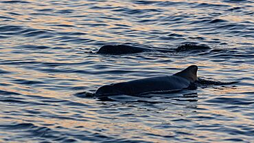
Bottlenose Dolphins, off Amity Point, 2021
|
|
| Population | 453 (2021 census) |
| • Density | 78.1/km2 (202/sq mi) |
| Established | 1824 |
| Postcode(s) | 4183 |
| Area | 5.8 km2 (2.2 sq mi) |
| Time zone | AEST (UTC+10:00) |
| Location |
|
| LGA(s) | Redland City |
| State electorate(s) | Oodgeroo |
| Federal Division(s) | Bowman |
Amity is a small coastal town in Queensland, Australia. It is located on North Stradbroke Island, which is often called Straddie by locals. The town is part of the City of Redland.
The traditional owners of this land are the Quandamooka people. They know Amity by its original name, Pulan Pulan. In 2021, about 453 people lived in Amity.
Contents
Exploring Amity's Location
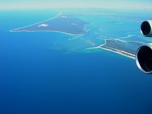
Amity is found on the north-western tip of North Stradbroke Island. This spot is known as Amity Point. Just north of Amity is the South Passage. This waterway separates North Stradbroke Island from Moreton Island.
Nearby Towns and Waterways
To the east of Amity, you'll find the small town of Point Lookout. South of Amity is Dunwich, the main town on North Stradbroke Island. A small stream called Wallum Creek runs along Amity's southern edge. The Rainbow Channel is a waterway right next to Amity Point in Moreton Bay.
Amity's Past: A Glimpse into History

Amity Point got its name in 1824. John Oxley named it after his ship, the brig Amity. He was sailing on this ship when he helped set up the Moreton Bay penal colony. For a short time, the area was called Cypress Point.
First European Settlement
John Gray chose Amity Point as a pilot station. This was because it was close to the South Passage, which led into Moreton Bay. It became the very first European settlement on Stradbroke Island.
Early Transport and Services
From 1885 to 1946, a supply boat called The Otter traveled between Brisbane's central business district and Amity. This boat also carried tourists. The Amity Point Post Office opened around 1942.
Schools in Amity's History
Amity Point State School first opened in 1919 but closed the next year. It reopened in 1937 as Cylinder Beach Provisional School. After eight months, it moved and became Amity Provisional School. This school closed in 1938. The school reopened again as Amity Point State School in 1951. It finally closed for good in 1961.
Who Lives in Amity?
The number of people living in Amity has changed over the years.
- In 2006, there were 408 people.
- In 2011, the population was 348 people. Most people (86%) were born in Australia.
- By 2016, the population grew to 387 people.
- In 2021, Amity had 453 residents.
Learning Opportunities in Amity
There are no schools directly in Amity. Students usually travel to nearby towns for their education.
Primary and Secondary Schools
The closest government primary school is Dunwich State School. It is located in Dunwich, to the south of Amity. For high school, students typically go to Cleveland District State High School. This school is on the mainland in Cleveland.
Amity's Public and Private Services
Amity has a small amount of services for its residents and visitors. Because it's a small town, people often travel to Dunwich for things like health care. They might also take a ferry to the mainland.
Public Services and Facilities
The government provides a few key services in Amity. These include:
- A single jetty for boats.
- A small library.
- A community hall for events.
- A Fire Station.
- A post office.
The Redland City Council runs the Amity Point Library. It's a very small library, located on the veranda of the community hall. It is open for a few hours each week. Amity has only a few roads. Claytons Road is the main road that connects Amity to the rest of the island. Locals often call it Point Lookout Road.
Private Businesses and Tourism
Private businesses in Amity mostly serve the many tourists who visit the island. Tourists come especially during holidays to enjoy the beaches. There is a caravan park for travelers who want to camp or stay in a caravan. The local cricket club is one of the few private places that also serves the people who live in Amity year-round.
Amity's Natural Surroundings
Amity is surrounded by beautiful nature. There are untouched forests to the south-east and lovely beaches everywhere else.
Unique Forests
The forests around Amity are subtropical rainforests. They have many different types of plants and animals. This is amazing because North Stradbroke Island is made mostly of sand. Most plants find it hard to grow in sand. These islands also have very old types of ferns. These ferns grow very slowly. Australian law protects these trees. Only the Aboriginal people, who are the original inhabitants of the island, are allowed to harvest them.
Beautiful Beaches and Marine Life
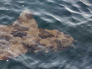
The beaches right around Amity have been affected by the Rainbow Channel. However, Flinders Beach, a few kilometers to the east, is in great condition. The Wanga Wallen Bank, about 500 meters south, is also very healthy. These areas are home to many different animals. You can find everything from U-Tube worms to Wobbegongs, which are small brown sharks.
Amity Point is known for having many sharks. However, shark incidents are very rare. There has been one recorded fatal incident. Despite safety measures like shark drumlines, which have been in place since 1997, a rare incident involving sharks occurred in the Rainbow Channel. The type of shark involved is not fully known. Experts suspect bull sharks, while locals have suggested tiger sharks.
 | Janet Taylor Pickett |
 | Synthia Saint James |
 | Howardena Pindell |
 | Faith Ringgold |


