
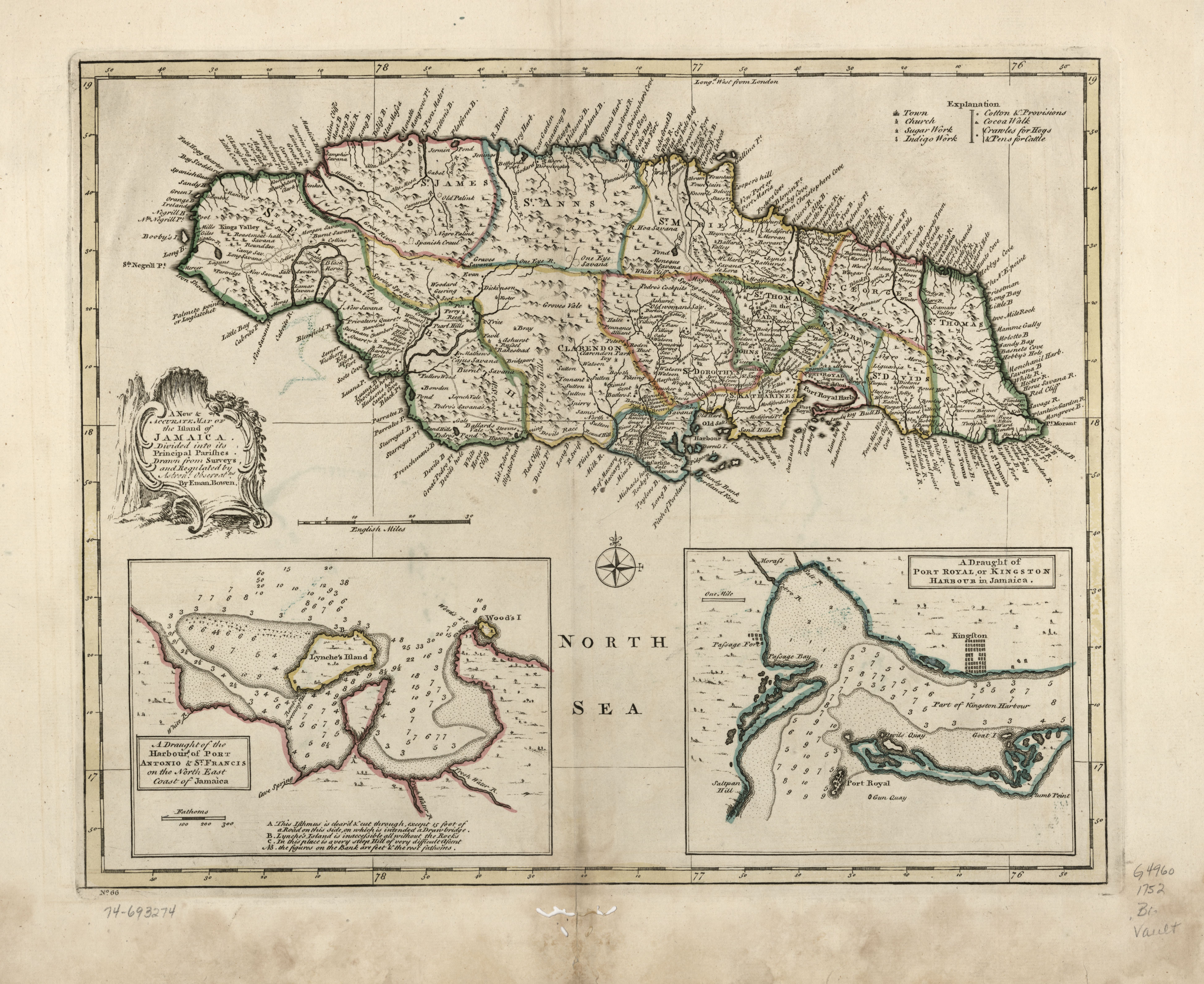
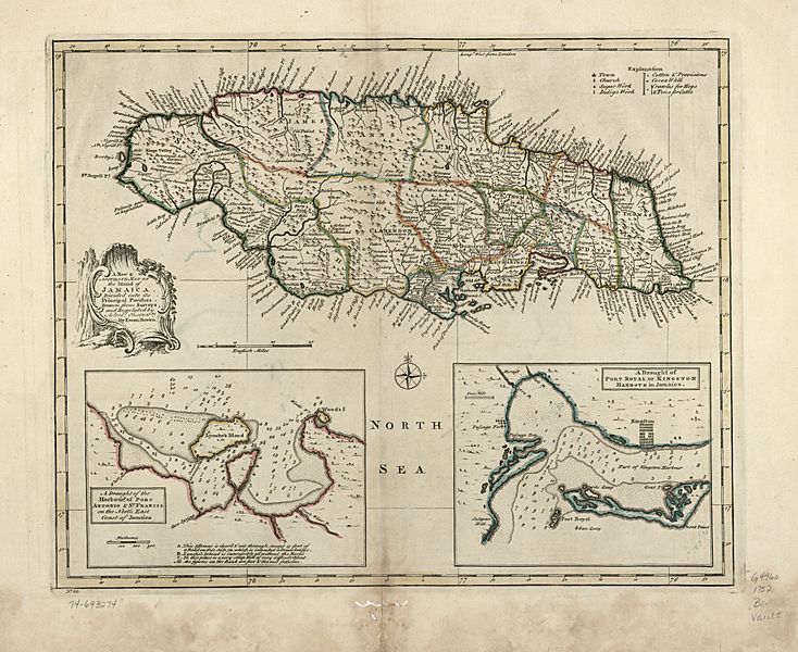
Image: A new & accurate map of the island of Jamaica. Divided into its principal parishes. LOC 74693274
Description: Scale ca. 1:780,000. Hand colored. Relief shown pictorially. "No. 66." From the author's A complete atlas or distinct view of the known world. 1752. LC Maps of North America, 1750-1789, 1913 Available also through the Library of Congress Web site as a raster image. Insets: A draught of the harbours of Port Antonio & St. Francis on the north east coast of Jamaica.--A draught of Port Royal, or Kingston Harbour in Jamaica. Vault AACR2
Title: A new & accurate map of the island of Jamaica. Divided into its principal parishes. LOC 74693274
Credit: https://www.loc.gov/item/74693274/
Author: Bowen, Emanuel
Permission: This map is available from the United States Library of Congress's Geography & Map Division under the digital ID g4960.ar191300. This tag does not indicate the copyright status of the attached work. A normal copyright tag is still required. See Commons:Licensing.
Usage Terms: Public domain
License: Public domain
Attribution Required?: No
Image usage
The following page links to this image:
