
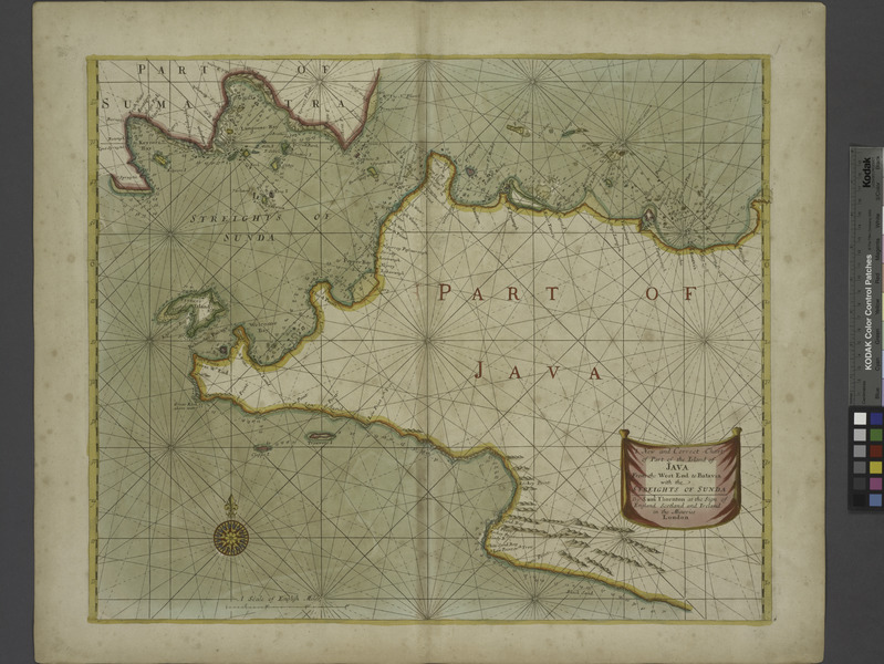
Image: A new and correct chart of part of the Island of JAVA from the West end to Batavia with the Streights of Sunda NYPL1640638f
Description: A new and correct chart of part of the Island of JAVA from the West end to Batavia with the Streights of Sunda; Atlases, gazetteers, guidebooks and other books / The sea-atlas : containing an hydrographical description of most of the sea-coasts of the known parts of the world.
Title: A new and correct chart of part of the Island of JAVA from the West end to Batavia with the Streights of Sunda NYPL1640638
Credit: New York Public Library
Author: Thornton, Samuel -- Cartographer
Permission: From The Lionel Pincus and Princess Firyal Map Division. http://maps.nypl.org This file is made available under the Creative Commons CC0 1.0 Universal Public Domain Dedication. The person who associated a work with this deed has dedicated the work to the public domain by waiving all of his or her rights to the work worldwide under copyright law, including all related and neighboring rights, to the extent allowed by law. You can copy, modify, distribute and perform the work, even for commercial purposes, all without asking permission. http://creativecommons.org/publicdomain/zero/1.0/deed.enCC0Creative Commons Zero, Public Domain Dedicationfalsefalse
Usage Terms: Creative Commons Zero, Public Domain Dedication
License: CC0
License Link: http://creativecommons.org/publicdomain/zero/1.0/deed.en
Attribution Required?: No
Image usage
The following page links to this image:
