
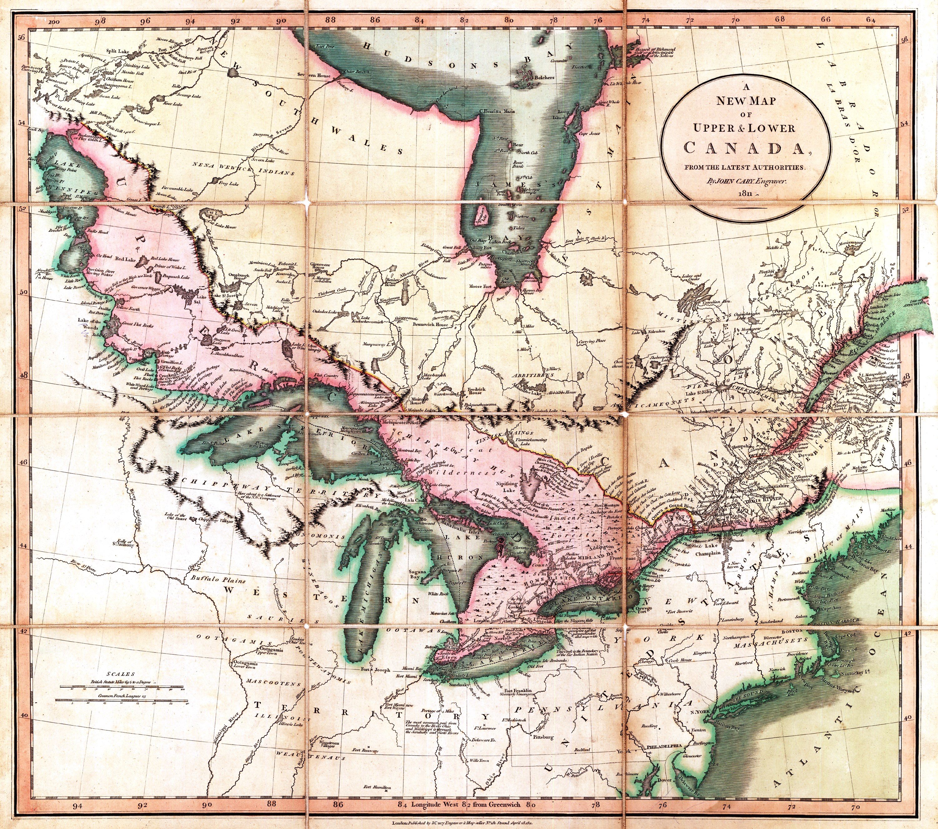
Image: A new map of Upper and Lower Canada from the latest authorities - 1811
Size of this preview: 678 × 600 pixels. Other resolutions: 271 × 240 pixels | 3,000 × 2,654 pixels.
Original image (3,000 × 2,654 pixels, file size: 2.77 MB, MIME type: image/jpeg)
Description: A New Map of Upper & Lower Canada, from the latest authorities
Title: A new map of Upper and Lower Canada from the latest authorities - 1811
Credit: http://crccf.uottawa.ca/passeport/I/IA2a/IA2a01_bbb.html
Author: John Cary
Usage Terms: Public domain
License: Public domain
Attribution Required?: No
Image usage
The following page links to this image:

All content from Kiddle encyclopedia articles (including the article images and facts) can be freely used under Attribution-ShareAlike license, unless stated otherwise.