
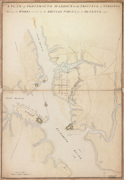
Image: A plan of Portsmouth Harbour in the province of Virginia shewing the works erected by the British forces for its defence, 1781. LOC gm71000689
Description: Scale ca. 1:95,000. Manuscript, pen-and-ink (black and red) and watercolor. Oriented with north toward the lower right. Relief shown by shading. Available also through the Library of Congress Web site as a raster image. Vault AACR2: 650/1; 650/2; 651/3
Title: A plan of Portsmouth Harbour in the province of Virginia shewing the works erected by the British forces for its defence, 1781. LOC gm71000689
Credit: https://www.loc.gov/item/gm71000689/
Author: Stratton, James
Permission: This map is available from the United States Library of Congress's Geography & Map Division under the digital ID g3884p.ar145700. This tag does not indicate the copyright status of the attached work. A normal copyright tag is still required. See Commons:Licensing for more information.
Usage Terms: Public domain
License: Public domain
Attribution Required?: No
Image usage
The following 3 pages link to this image:
