
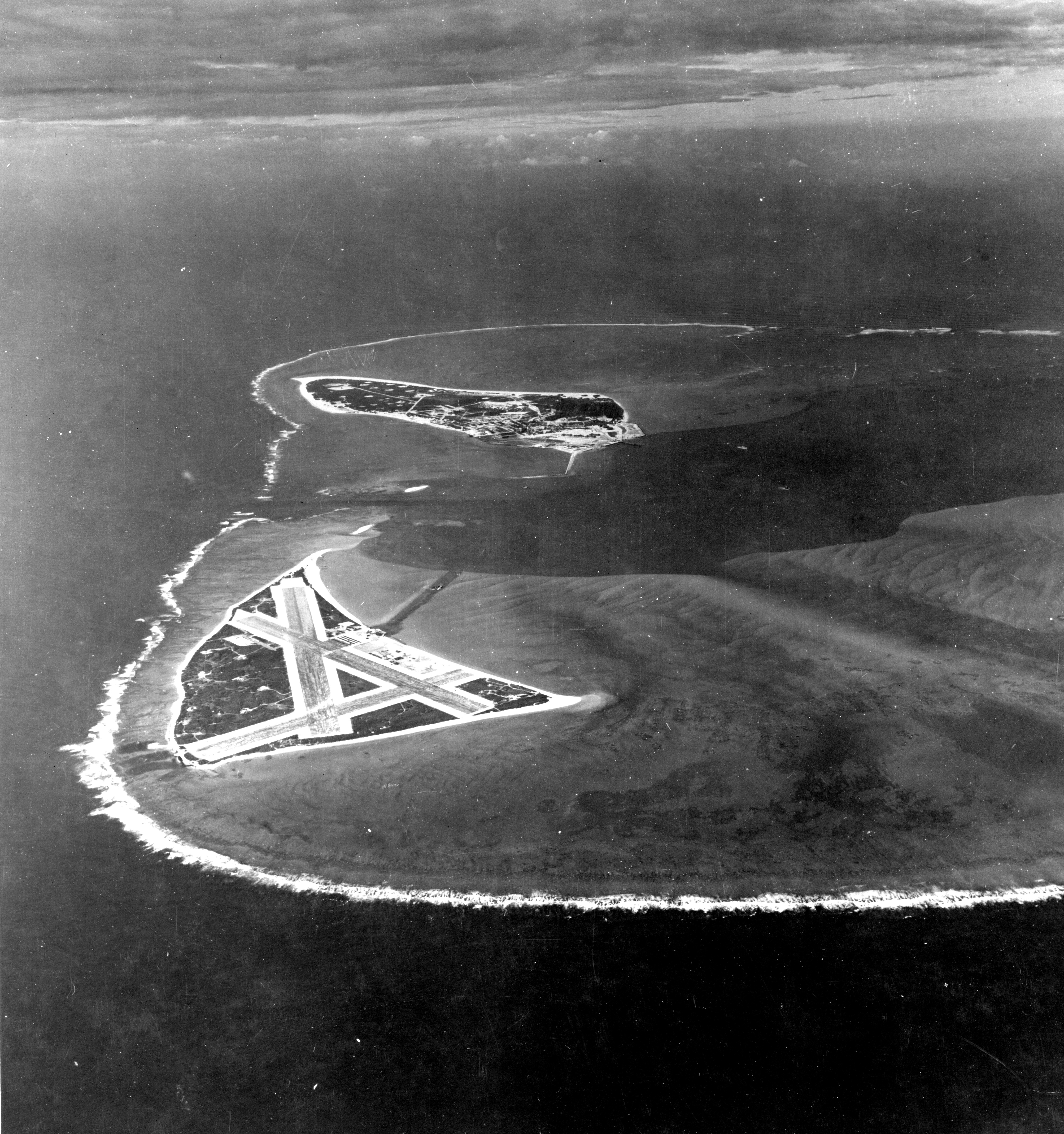
Image: Aerial view of Midway Atoll on 24 November 1941 (80-G-451086)
Size of this preview: 562 × 599 pixels. Other resolutions: 225 × 240 pixels | 4,500 × 4,797 pixels.
Original image (4,500 × 4,797 pixels, file size: 5.11 MB, MIME type: image/jpeg)
Description: Aerial photograph of Midway Atoll, looking just south of west across the southern side of the atoll, 24 November 1941. Eastern Island, then the site of Midway's airfield, is in the foreground. Sand Island, location of most other base facilities, is across the entrance channel.
Title: Aerial view of Midway Atoll on 24 November 1941 (80-G-451086)
Credit: U.S. Navy photo 80-G-451086
Author: Unknown author
Usage Terms: Public domain
License: Public domain
Attribution Required?: No
Image usage
The following image is a duplicate of this image (more details):
The following 2 pages link to this image:

All content from Kiddle encyclopedia articles (including the article images and facts) can be freely used under Attribution-ShareAlike license, unless stated otherwise.
.jpg)