Image: AinuPlaceNames

Size of this preview: 227 × 598 pixels. Other resolutions: 91 × 240 pixels | 3,840 × 10,120 pixels.
Original image (3,840 × 10,120 pixels, file size: 6.48 MB, MIME type: image/png)
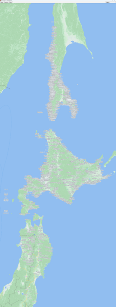
Description: アイヌ語由来の地名 地図はGMTED2010(パブリックドメイン)を用いている。 参考文献:
南樺太地名集 https://note.com/vcbp_a/m/md0d77f933104 (Websites containing the place names of the following old map data) アイヌ語地名リスト - アイヌ政策推進局アイヌ政策課 https://www.pref.hokkaido.lg.jp/ks/ass/new_timeilist.html (Websites containing the place names of the following old map data) 金田一京助著・工藤雅樹編2004「古代蝦夷とアイヌ (平凡社ライブラリー き 8-2 金田一京助の世界 2)」 山田秀三1993「東北・アイヌ語地名の研究」 間宮林蔵1810「黒竜江中州并天度」 間宮林蔵1811「北蝦夷島地図」 伊能忠敬(原図)・高橋景保(編)1827頃「日本図」 藤田良1853「蝦夷闔境輿地全図」 工藤東平1854「大日本沿海要疆全󠄁圖」 加賀藩士・豊島毅1854「改正蝦夷全図」 目賀田守蔭1855頃「北延叙地図」
Usage Terms: Public domain
Image usage
The following page links to this image:

All content from Kiddle encyclopedia articles (including the article images and facts) can be freely used under Attribution-ShareAlike license, unless stated otherwise.
