
Image: Alaska boundary dispute

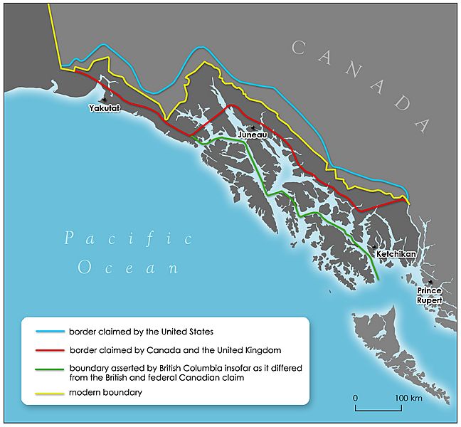
Description: Varying claims in Southeast Alaska before arbitration in 1903. In blue is the border claimed by the United States, in red is the border claimed by Canada and the United Kingdom. Green is the boundary asserted by British Columbia insofar as it differed from the British and federal Canadian claim. Yellow indicates the modern border.
Title: Alaska boundary dispute
Credit: Redrawn version of File:1926 Canada-Alaska 1903 boundary-map.jpg, portion of 1926 map by William R. Shepherd (now in public domain in United States) manipulated for article display usefulness by AnonMoos.
Author: William R. Shepherd, User:AnonMoos, Rudyologist
Permission: original map image is "PD-US", Rudyologist declares modifications to also be PD
Usage Terms: Public domain
License: Public domain
Attribution Required?: No
Image usage
The following page links to this image:
