
Image: Alemannic-Dialects-Map-English
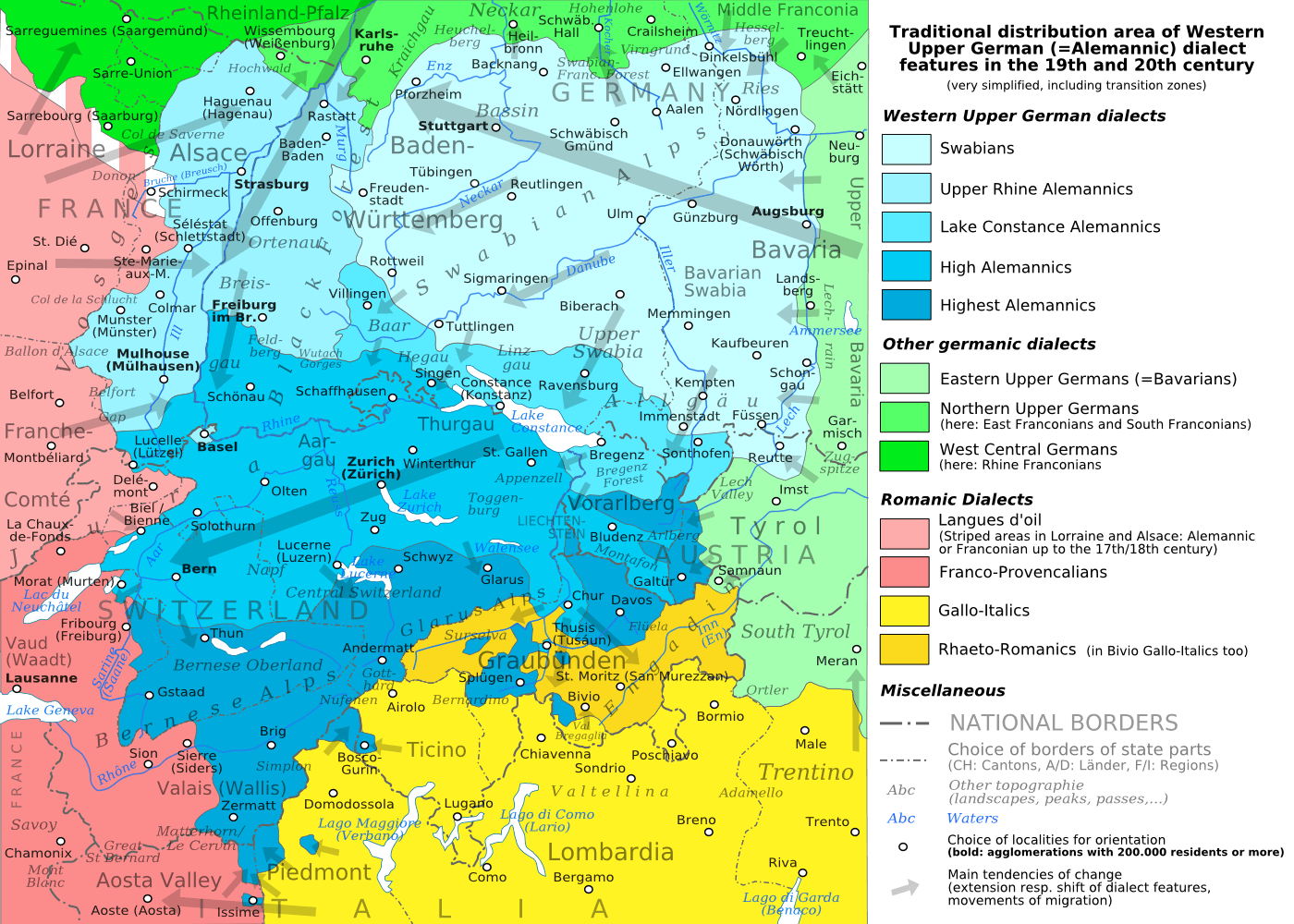
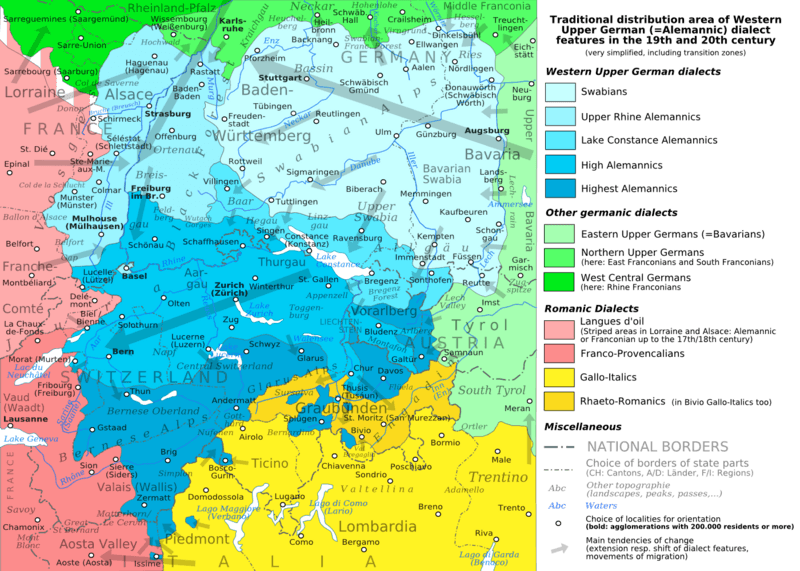
Description: The traditional distribution area of the western upper german (=alemannic) dialects in the 19th and 20th century. Source: Mainly these articles in the german wikipedia: * Alemannische Dialekte * Grenzorte des alemannischen Dialektraums * Traditionell rätoromanischsprachiges Gebiet Graubündens and * Sprachen und Dialekte in der Region Elsass, plus the (younger) literature, which is mentioned there. This area, having been quite stable for at least some 300 years up to the 19th century, saw consecutively more or less strong changes by industrialisation, population growth, migrations and political developments.
Title: Alemannic-Dialects-Map-English
Credit: Alemannic-Dialects-Map-English.svg
Author: Alemannic-Dialects-Map-English.svg: *Alemannic-Dialects-Map-German.svg: *Alemannic_language_location_map_in_1950-de.svg: *derivative work: Pyrokrat (talk) Alemannic_language_location_map_in_1950-fr.svg: Sémhur derivative work: Testtube (talk) derivative work: Testtube (talk)
Usage Terms: Creative Commons Attribution-Share Alike 3.0
License: CC BY-SA 3.0
License Link: http://creativecommons.org/licenses/by-sa/3.0
Attribution Required?: Yes
Image usage
The following 3 pages link to this image:
