
Image: Americae mappa generalis secundum legitimas projectionis stereographicae regulas CTASC
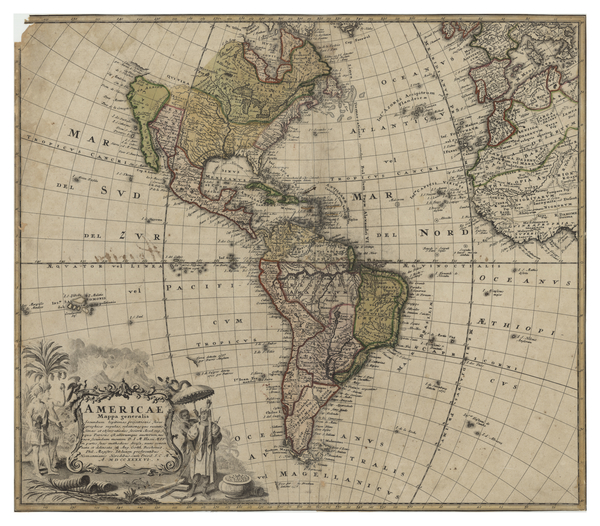
Description: Latin map of the Americas. Major cities, bodies of water, oceans, countries and regions are labelled. International borders are outlined. In some areas, the names of Indigenous communities are listed. There is a cartouche in the lower left corner with depictions of Indigenous people and a pot of gold. Relief shown pictorially.
Title: Americae mappa generalis secundum legitimas projectionis stereographicae regulas
Credit: York University Libraries, Clara Thomas Archives & Special Collections, Historical map collection, HMC0017. http://digital.library.yorku.ca/islandora/object/yul:1153578
Author: Johann Matthias Hase
Usage Terms: Public domain
License: Public domain
Attribution Required?: No
Image usage
The following page links to this image:
