Johann Matthias Hase facts for kids
Johann Matthias Hase (sometimes called Johannes Hasius) was a German scientist. He was born on January 14, 1684, and passed away on September 24, 1742. He was a talented mathematician, an astronomer (someone who studies stars and planets), and a cartographer (a mapmaker).
His Life and Work
Johann Matthias Hase taught at universities in Leipzig and his hometown, Augsburg. In 1720, he became a professor of mathematics at the University of Wittenberg.
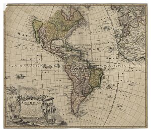
Hase was well-known for creating maps for a publishing company called Homännische Erben. These maps were very detailed and showed different parts of the world.
Some of his important maps include:
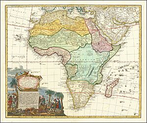
- A map of Africa, called Africa Secundum legitimas Projectionis Stereographiae regulas (1737). This map was based on earlier works by another famous mapmaker, Leo Africanus.
- A map of the ancient Kingdoms of David and Solomon (1739). He also published a big book about these kingdoms, which included maps of Syria and Egypt.
- A map of Europe, called Europa secundum legitimas projectionis stereographieae regulas (1743).
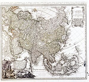
- A map of Asia, called Asia secundum legitimas projectionis stereographieae regulas (1744). This map was published after he passed away.

- A map of Hungary and nearby countries, called Hungariae ampliori significatu et veteris vel Methodicae complexae Regna (1744). This map showed the Kingdom of Hungary and lands along the Danube River in Southeast Europe.
Hase died in Wittenberg. There's even a crater on the moon named after him!
Stories on His Maps
Johann Matthias Hase added special pictures to his maps. These pictures are called allegories. An allegory is a drawing or scene that tells a story or has a deeper meaning.
For example, on his map of Africa, he drew a large scene in the corner. It showed people dressed in different ways, like European traders and African rulers. There were also animals like lions. These pictures helped to explain the culture and life of the continent.
His map of Asia also included similar allegorical scenes. These artistic additions made his maps unique and interesting!
 | Madam C. J. Walker |
 | Janet Emerson Bashen |
 | Annie Turnbo Malone |
 | Maggie L. Walker |


