
Image: Anacostia River Valley - US Army Corps of Engineers - middle portion only - 1891

Size of this preview: 800 × 324 pixels. Other resolutions: 320 × 129 pixels | 5,000 × 2,022 pixels.
Original image (5,000 × 2,022 pixels, file size: 10.32 MB, MIME type: image/jpeg)
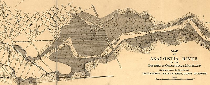
Description: Middle porton of a map of the en:Anacostia River in the en:District of Columbia, surveyed and created on October 24, 1891, by Lieutenant Colonel Peter C. Hains, U.S. Army Corps of Engineers. Note the location of the "Anacostia flats," the tidal marshes due to be filled in by the Corps of Engineers.
Title: Anacostia River Valley - US Army Corps of Engineers - middle portion only - 1891
Credit: http://hdl.loc.gov/loc.gmd/g3852a.ct001351
Author: U.S. Army Corps of Engineers. Geography and Map Division, Library of Congress. Peter C. Hains, engineer and mapmaker.
Usage Terms: Public domain
License: Public domain
Attribution Required?: No
Image usage
The following page links to this image:

All content from Kiddle encyclopedia articles (including the article images and facts) can be freely used under Attribution-ShareAlike license, unless stated otherwise.