
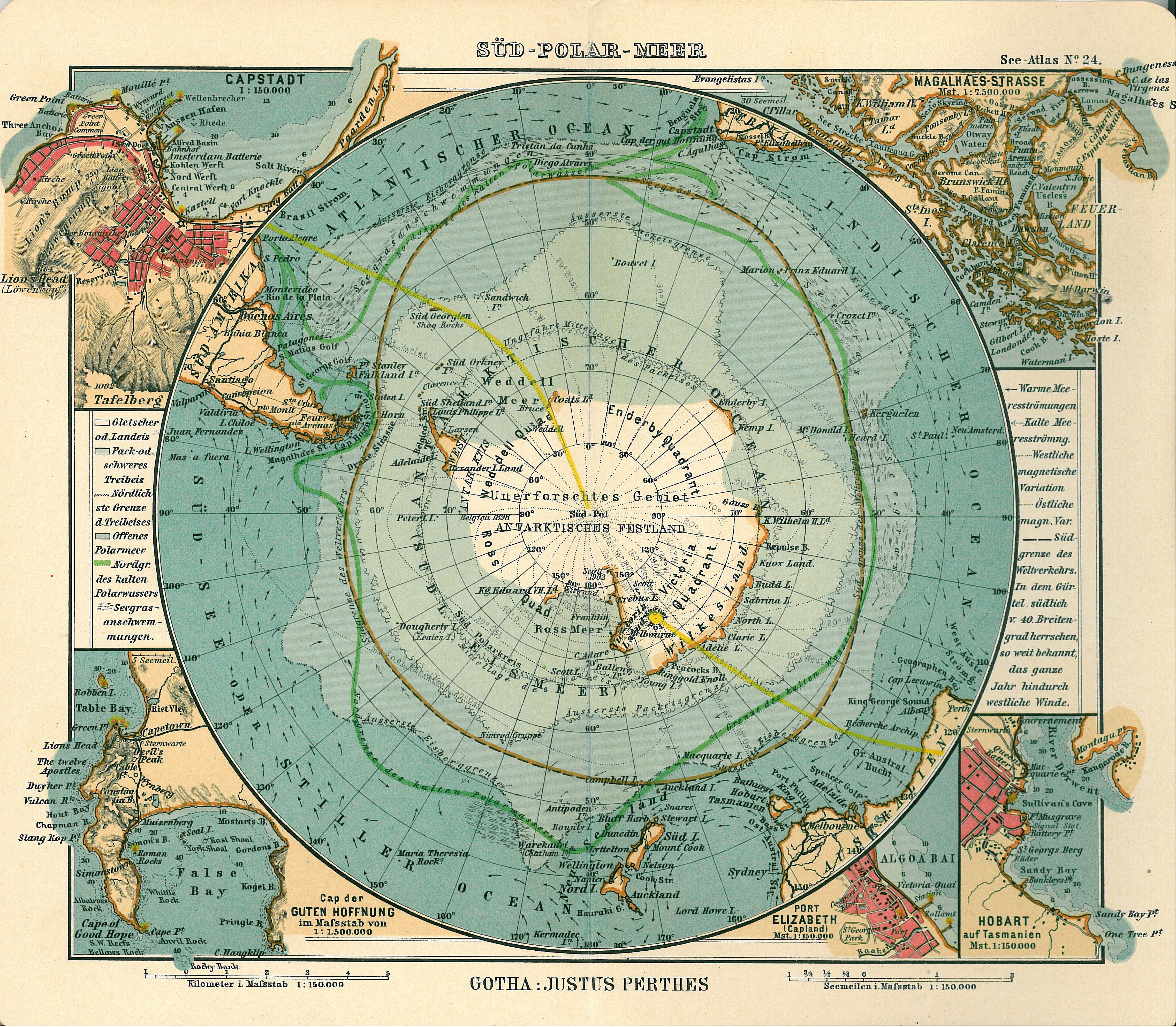
Image: Antarctica map
Size of this preview: 686 × 599 pixels. Other resolutions: 275 × 240 pixels | 4,549 × 3,973 pixels.
Original image (4,549 × 3,973 pixels, file size: 6.18 MB, MIME type: image/jpeg)
Description: Page 24, Antarctica, Inset maps of Cape town, Cape of good hope, Magalhaes strait, Hobart, Port Elizabeth
Usage Terms: Public domain
Image usage
The following 2 pages link to this image:

All content from Kiddle encyclopedia articles (including the article images and facts) can be freely used under Attribution-ShareAlike license, unless stated otherwise.