
Image: Arab-Byzantine frontier zone

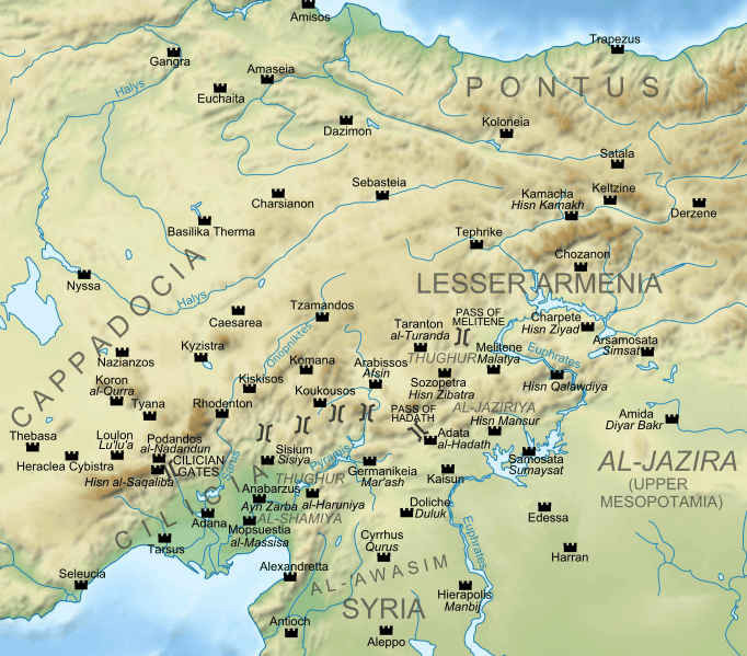
Description: Map of the Arab-Byzantine frontier zone from the late 7th to the 10th centuries, with the major settlements and fortresses (Arab names in italics). Base map taken from Middle East topographic map-blank.svg, sources used: John Haldon, The Palgrave Atlas of Byzantine History. London 2005, p. 109; W.E. Kaegi, Byzantium and the early Islamic conquests. Cambridge 1995, p. 241; John Haldon, Byzantium in the Seventh Century: The Transformation of a Culture. Cambridge 1997, p. 106
Title: Arab-Byzantine frontier zone
Credit: Own work
Author: Cplakidas
Usage Terms: Creative Commons Attribution-Share Alike 3.0
License: CC BY-SA 3.0
License Link: https://creativecommons.org/licenses/by-sa/3.0
Attribution Required?: Yes
Image usage
The following 3 pages link to this image:
