
Image: Arecibo observatory damage map

Size of this PNG preview of this SVG file: 480 × 600 pixels. Other resolution: 192 × 240 pixels.
Original image (SVG file, nominally 512 × 640 pixels, file size: 45 KB)
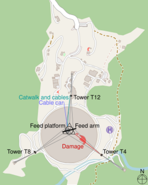
Description: Map of Arecibo Observatory after cable damage by CMG Lee. The base map is from OpenStreetMap, info from http://egg.astro.cornell.edu/alfalfa/pract/pract_ao.htm and damage was traced from the photograph at http://nature.com/articles/d41586-020-03270-9 .
Title: Arecibo observatory damage map
Credit: http://render.openstreetmap.org/cgi-bin/export?bbox=-66.7562234401703,18.34173518274665,-66.74869179725648,18.350910519266023&scale=10000&format=svg
Author: cmglee and Openstreetmap contributors
Usage Terms: Creative Commons Attribution-Share Alike 4.0
License: CC BY-SA 4.0
License Link: https://creativecommons.org/licenses/by-sa/4.0
Attribution Required?: Yes
Image usage
The following page links to this image:

All content from Kiddle encyclopedia articles (including the article images and facts) can be freely used under Attribution-ShareAlike license, unless stated otherwise.