
Image: Arnhem Map 4

Size of this preview: 800 × 529 pixels. Other resolutions: 320 × 212 pixels | 2,000 × 1,323 pixels.
Original image (2,000 × 1,323 pixels, file size: 1.05 MB, MIME type: image/jpeg)
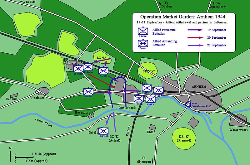
Description: The Allied withdrawal and formation of the Oosterbeek perimeter. 19-21 September 1944.
Title: Arnhem Map 4
Credit: I created this work entirely by myself, based on information from: Badsey, Stephen (1993) Arnhem 1944, Operation Market Garden, Osprey Publishing Ltd, p. 46−47 ISBN: 1-85532-302-8.
Author: Ranger Steve (talk)
Usage Terms: Creative Commons Attribution-Share Alike 3.0
License: CC BY-SA 3.0
License Link: https://creativecommons.org/licenses/by-sa/3.0
Attribution Required?: Yes
Image usage
The following page links to this image:

All content from Kiddle encyclopedia articles (including the article images and facts) can be freely used under Attribution-ShareAlike license, unless stated otherwise.