
Image: ArnoldExpeditionTopoMapAnnotated
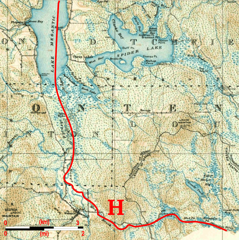
Description: An annotated extract from a 20th-century topographical map indicating the route of Benedict Arnold's expedition across the height of land between the Kennebec River (Maine) and the Chaudière River (Quebec).
Title: ArnoldExpeditionTopoMapAnnotated
Credit: Markings original work by uploader; base map is from the Library and Archive of Quebec: http://services.banq.qc.ca/sdx/cep/document.xsp?id=0002684670 Cote : G 3400 s63 C37 21-E-07 1924 CAR Numéro SNRC : 21-E-07 Numéro catalogue Iris : 0002684670
Author: Markings: User:Magicpiano; Base map: work of Canadian government, Survey Division Office, Department of National Defence
Permission: For background information, see the explanations on Non-U.S. copyrights. Note: This tag should not be used for sound recordings.
Usage Terms: Public domain
License: Public domain
Attribution Required?: No
Image usage
The following page links to this image:
