
Image: Atlas-Mountains-Labeled-2 new
Size of this preview: 710 × 600 pixels. Other resolutions: 284 × 240 pixels | 1,095 × 925 pixels.
Original image (1,095 × 925 pixels, file size: 260 KB, MIME type: image/jpeg)
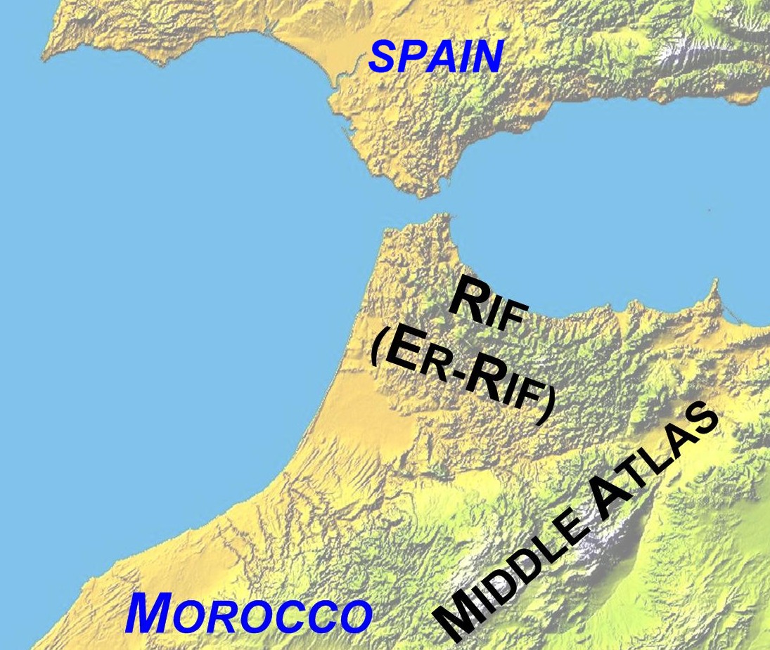
Description: Map of Northwest Africa showing mountain ranges and political boundaries. Made by author. Cropped from NASA source and labelled using Debenham, Frank (1977) Reader's Digest Great World Atlas 3rd edition London: Reader's Digest Association (Great Britain) ISBN:0340016361 p.43 for location of named features 05:07, 27 June 2006 (UTC)
Title: Atlas-Mountains-Labeled-2 new
Credit: NASA map
Author: Jimfbleak (talk)
Usage Terms: Public domain
License: Public domain
Attribution Required?: No
Image usage
The following page links to this image:

All content from Kiddle encyclopedia articles (including the article images and facts) can be freely used under Attribution-ShareAlike license, unless stated otherwise.