
Image: Atomic bomb 1945 mission map
Size of this PNG preview of this SVG file: 456 × 600 pixels. Other resolution: 182 × 240 pixels.
Original image (SVG file, nominally 1,919 × 2,525 pixels, file size: 392 KB)
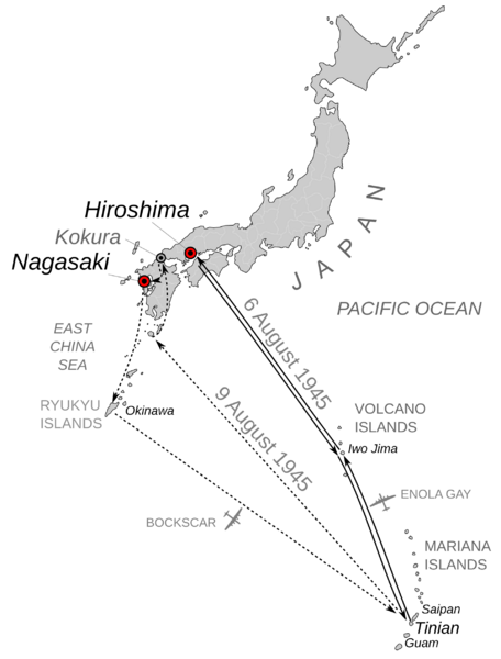
Description: Mission map for the bombings of Hiroshima and Nagasaki, August 6 and August 9, 1945. Scale is not consistent due to curvature of Earth. Angles and locations are approximate. Kokura included because it was original target for August 9 but weather obscured visibility and so Nagasaki was chosen as backup.
Usage Terms: Public domain
Image usage
The following page links to this image:

All content from Kiddle encyclopedia articles (including the article images and facts) can be freely used under Attribution-ShareAlike license, unless stated otherwise.