
Image: BAS174 Port Lockroy with attributes - Operation Tabarin Base A
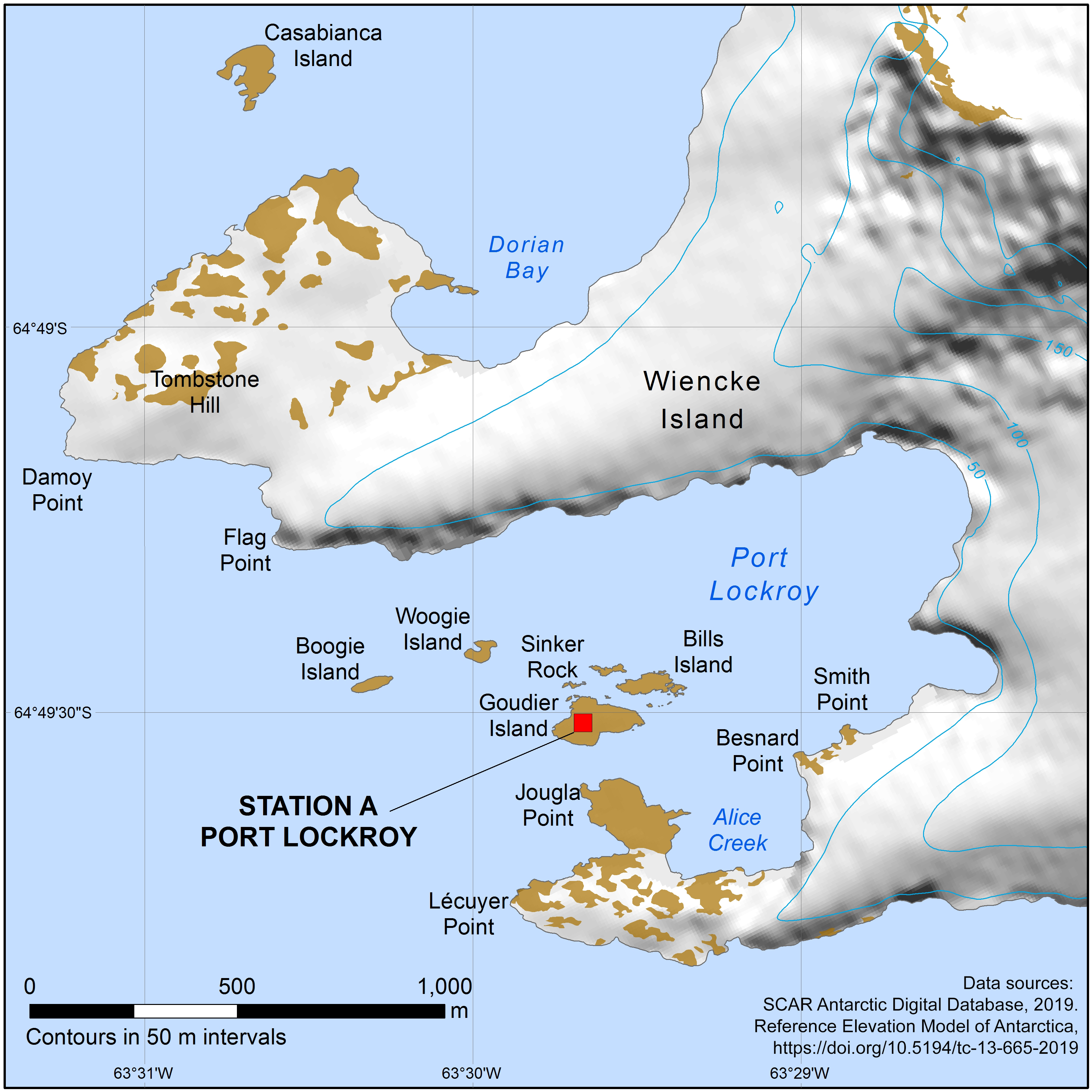
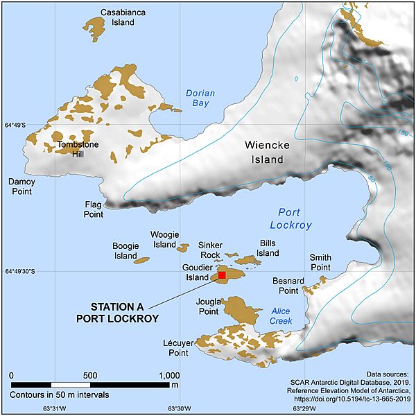
Description: Base A, Port Lockroy, was the main research station of Operation Tabarin, the British World War 2 expedition to Antarctica, during its first season, 1944-45. The Base was occupied until 1962 and is now an historic site. Map created by the digital mapping officer at British Antarctic Survey from the SCAR Antarctic Digital Database.
Title: BAS174 Port Lockroy with attributes - Operation Tabarin Base A
Credit: British Antarctic Survey Mapping and Geographic Information Centre mapsales@bas.ac.uk
Author: British Antarctic Survey Mapping and Geographic Information Centre
Permission: This work is free and may be used by anyone for any purpose. If you wish to use this content, you do not need to request permission as long as you follow any licensing requirements mentioned on this page. The Wikimedia Foundation has received an e-mail confirming that the copyright holder has approved publication under the terms mentioned on this page. This correspondence has been reviewed by a Volunteer Response Team (VRT) member and stored in our permission archive. The correspondence is available to trusted volunteers as ticket #2021060910005651. If you have questions about the archived correspondence, please use the VRT noticeboard. Ticket link: https://ticket.wikimedia.org/otrs/index.pl?Action=AgentTicketZoom&TicketNumber=2021060910005651 Find other files from the same ticket:
Usage Terms: Creative Commons Attribution-Share Alike 4.0
License: CC BY-SA 4.0
License Link: https://creativecommons.org/licenses/by-sa/4.0
Attribution Required?: Yes
Image usage
The following page links to this image:
