
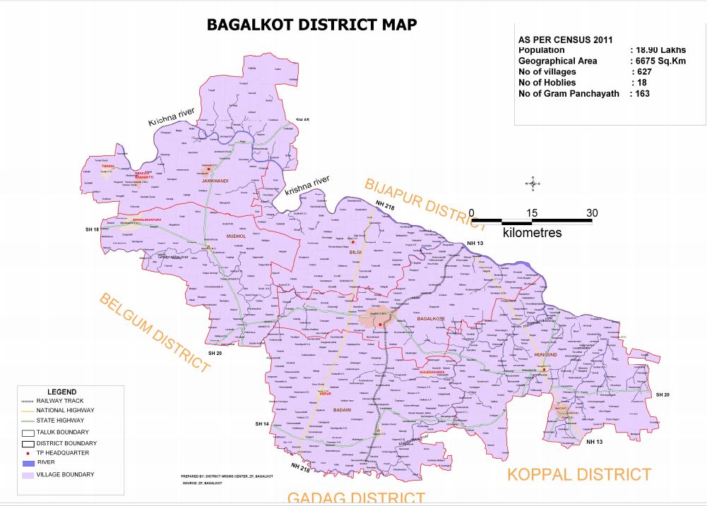
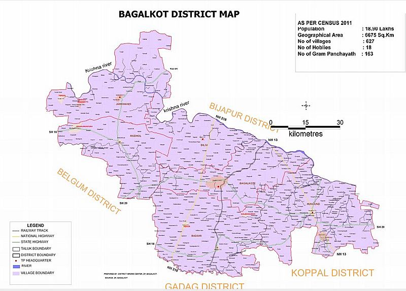
Image: Bagalkot district Map by villages
Size of this preview: 800 × 573 pixels. Other resolutions: 320 × 229 pixels | 1,001 × 717 pixels.
Original image (1,001 × 717 pixels, file size: 110 KB, MIME type: image/jpeg)
Description: Bagalkot district Map by villages
Title: Bagalkot district Map by villages
Credit: https://cdn.s3waas.gov.in/s3a1d33d0dfec820b41b54430b50e96b5c/uploads/2018/07/2018073052.jpg
Author: Zilla Panchayat, Bagalkot
Usage Terms: Government Open Data License – India
License: GODL-India
License Link: https://data.gov.in/sites/default/files/Gazette_Notification_OGDL.pdf
Attribution Required?: Yes
Image usage

All content from Kiddle encyclopedia articles (including the article images and facts) can be freely used under Attribution-ShareAlike license, unless stated otherwise.