
Image: Balkan boundaries1876map1914

Size of this preview: 800 × 579 pixels. Other resolutions: 320 × 232 pixels | 984 × 712 pixels.
Original image (984 × 712 pixels, file size: 73 KB, MIME type: image/png)
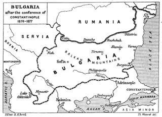
Description: Map from "Report of the International Commission To Inquire into the Causes and Conduct of the Balkan Wars" 1914.
Title: Balkan boundaries1876map1914
Credit: a map
Author: Source: [1] - JPG to PNG by Iain 09:30, 13 June 2006 (UTC)
Permission: Original File PD
Usage Terms: Public domain
License: Public domain
Attribution Required?: No
Image usage
The following page links to this image:

All content from Kiddle encyclopedia articles (including the article images and facts) can be freely used under Attribution-ShareAlike license, unless stated otherwise.