
Image: Banks-map-1938

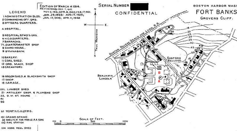
Description: 1938 map of Ft. Banks shows the four mortar pits of Batteries Lincoln(on the west) and Kellogg (on the east) at the center of the map. The two northerly "B" pits (see red labels) each (by 1938) contained two mortars, while the southerly "A" pits contained four mortars each. Today (2010), only Kellogg Pit B (the northeastern pit) is visible from the surface. The others have been filled in and/or built over. The site is now occupied by the Winthrop Dept. of Public Works and a private development of apartment buildings. The abandoned magazines of the fort are used for storage. The fort, established in 1890, contained 42.9 acres of land (as listed by the U.S. Army Engineers in 1945). Its mortar batteries were officially abandoned by the Coast Artillery on December 15, 1942. The fort was decommissioned in 1947.
Title: Banks-map-1938
Credit: U.S. Army Engineers, "Harbor Defenses of Boston" (maps of various dates)
Author: U.S. Army Engineers
Usage Terms: Public domain
License: Public domain
Attribution Required?: No
Image usage
The following page links to this image:
