
Image: BattleOfFortsClintonAndMontgomery1777

Size of this preview: 800 × 428 pixels. Other resolutions: 320 × 171 pixels | 4,132 × 2,212 pixels.
Original image (4,132 × 2,212 pixels, file size: 2.42 MB, MIME type: image/jpeg)
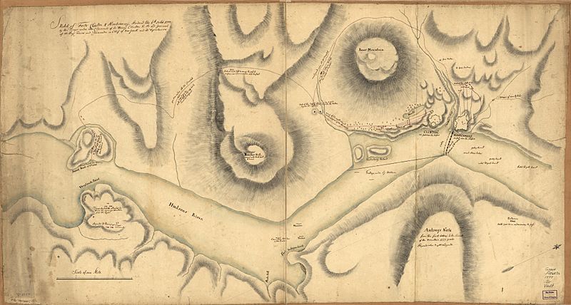
Description: This is a map depicting the 1777 Battle of Forts Clinton and Montgomery, showing military movements. Drawn by a British military engineer.
Title: BattleOfFortsClintonAndMontgomery1777
Credit: This map is available from the United States Library of Congress's Geography & Map Division under the digital ID g3804f.ar119300. This tag does not indicate the copyright status of the attached work. A normal copyright tag is still required. See Commons:Licensing for more information.
Author: Unknown authorUnknown author
Usage Terms: Public domain
License: Public domain
Attribution Required?: No
Image usage
The following 2 pages link to this image:

All content from Kiddle encyclopedia articles (including the article images and facts) can be freely used under Attribution-ShareAlike license, unless stated otherwise.