
Image: BearsdenExpansion

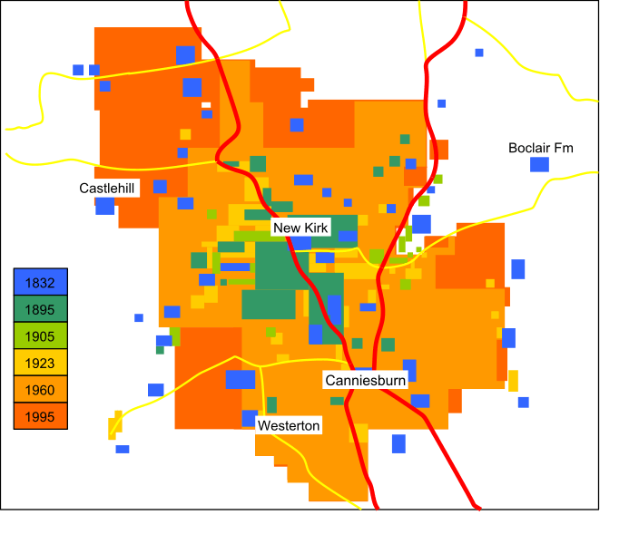
Description: Graphic showing the expansion of the town of Bearsden, East Dunbartonshire, from 1832 to 1995. The dates shown do not relate directly to the building of housing schemes, but to the dates of maps from which the information is drawn. The presence of buildings from an early map does not mean that the same buildings exist on subsequent maps - the redevelopment of plots of land is commonplace. Sources are as follows: John Thomson's Atlas of Scotland (1832); Ordnance Survey One-Inch 2nd Ed Sheet 30 (1895); Ordnance Survey One-Inch Popular Edition Sheet 72 (1923); Ordnance Survey Landranger series; Google Maps.
Title: BearsdenExpansion
Credit: Own work (Original text: I (Wikiwayman (talk)) created this work entirely by myself.)
Author: Wikiwayman (talk)
Usage Terms: Creative Commons Attribution-Share Alike 3.0
License: CC BY-SA 3.0
License Link: http://creativecommons.org/licenses/by-sa/3.0
Attribution Required?: Yes
Image usage
The following page links to this image:
