
Image: Beaubassin1755

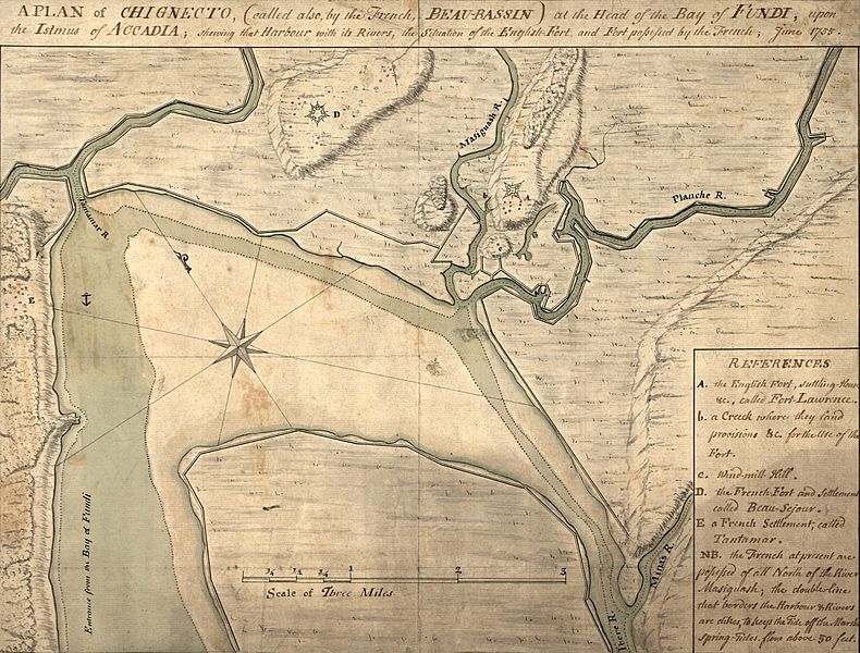
Description: A map depicting the Beaubassin region of Nova Scotia in 1755. The area was then on the frontier between British Nova Scotia and French Acadia. The caption reads: A plan of Chignecto (called also by the French Beau-Bassin) at the head of the Bay of Fundi upon the Istmus of Accadia shewing that harbour with its rivers, the situation of the English fort and fort possessed by the French, June 1755. The image has been cropped from the original to remove a border.
Title: Beaubassin1755
Credit: This map is available from the United States Library of Congress's Geography & Map Division under the digital ID g3432c.ct001306. This tag does not indicate the copyright status of the attached work. A normal copyright tag is still required. See Commons:Licensing for more information.
Author: Unknown authorUnknown author
Usage Terms: Public domain
License: Public domain
Attribution Required?: No
Image usage
The following 3 pages link to this image:
