Isthmus of Chignecto facts for kids
The Isthmus of Chignecto is a narrow strip of land. It connects the Nova Scotia peninsula to the rest of North America. This important land bridge borders the Canadian provinces of New Brunswick and Nova Scotia.
The isthmus separates two large bodies of water. On one side is Chignecto Bay, which is part of the Bay of Fundy. On the other side is Baie Verte, an arm of the Northumberland Strait. This strait is connected to the Gulf of St. Lawrence. The isthmus stretches from Dieppe, New Brunswick in the north to Amherst, Nova Scotia in the south. At its narrowest point, between Amherst and Tidnish, it is only 24 kilometres (15 miles) wide.
Because of its key location, the Isthmus of Chignecto has been very important throughout history. Many groups have wanted to control it. The name "Chignecto" comes from the Mi'kmaq word Siknikt. It means "drainage place." This is also the name of the Mi'kmaq District where the land bridge is located.
Contents
Geography of Chignecto Isthmus
Most of the land on the isthmus is very low. It is not far above sea level. A large part of it is made up of the Tantramar Marshes. You can also find tidal rivers, mud flats, and different kinds of marshes here. There are also areas of mixed forest.
Some higher areas rise above the low lands. These are ridges along the Bay of Fundy shore. They include the Fort Lawrence Ridge in Nova Scotia. In New Brunswick, you'll find the Aulac Ridge, Sackville Ridge, and Memramcook Ridge.
The eastern side of the isthmus, along the Northumberland Strait, is mostly forested. Winding tidal rivers, called estuaries, reach inland here. The narrowest point on the Northumberland shoreline is at Baie Verte. If sea levels were to rise by 12 meters (about 40 feet), the isthmus would be underwater. This would turn mainland Nova Scotia into an island.
Transportation Across the Isthmus
The Isthmus of Chignecto has been a vital travel route for centuries. Since the 1600s, both French and British settlers built military roads across it. These roads helped them move troops and supplies.
Early Railways and Canals
In 1872, the Intercolonial Railway of Canada built a main rail line. It connected Halifax to Moncton, New Brunswick. This railway crossed the southern part of the isthmus. It ran along the edge of the Bay of Fundy. It also crossed the Tantramar Marshes between Amherst, Nova Scotia and Sackville, New Brunswick.
Later, in 1886, another railway line was built. It went from Sackville to Port Elgin. From there, it continued to Cape Tormentine. Cape Tormentine was a port for an iceboat service. In 1917, Canadian National Railways started a rail ferry service. This connected to Prince Edward Island and its railway.
In the mid-1880s, a huge project was started here. It was called the Chignecto Ship Railway. This railway was designed to carry small cargo and passenger ships! It would have moved them from Amherst to Tidnish on the Northumberland Strait. However, this ship railway was never fully completed or used.
In the 1950s, people discussed building a Chignecto Canal. This canal would have been a shortcut for ships. It would have allowed ocean-going ships to travel between Saint John and the Great Lakes. This would have saved them from having to sail all the way around Nova Scotia. The project was supported by New Brunswick's government. But it never went beyond the planning stage.
Modern Highways
In the early 1960s, the Trans-Canada Highway was built. It connected Nova Scotia and Prince Edward Island. Route 2 in New Brunswick and Highway 104 in Nova Scotia were built next to the railway tracks. This highway was later upgraded to a four-lane expressway in the 1990s.
Route 16 in New Brunswick was also built. It connected Aulac to the ferry terminal at Cape Tormentine. In 1997, this route was changed. It now connects to the Confederation Bridge at Cape Jourimain.
History of the Isthmus of Chignecto
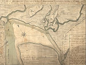
The first European settlements on the isthmus were French. A growing Acadian farming community called Beaubassin was located here. In 1713, the isthmus became a dividing line. It separated the British colony of Nova Scotia from French territory.
French military forces built Fort Beauséjour in 1749. This was a response to the British building their own fort. The British outpost was called Fort Lawrence. It was on a ridge just to the east.
Between these two forts was a tidal stream called the Missaquash River. France generally believed this river was the boundary. But the two powers never officially agreed on a border. France also built Fort Gaspereau on the Northumberland Strait. This helped them control travel on the isthmus.
King William's War (1689-1697)

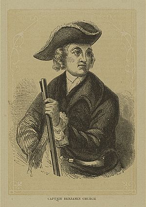
During King William's War, there was a major raid on the Isthmus of Chignecto. An English colonial leader named Benjamin Church led it. This raid was in response to earlier attacks by French and Native forces.
Church and about 400 men arrived at Beaubassin on September 20. They surprised the Acadians. Many Acadians ran away. Some showed Church papers proving they had promised loyalty to the English king. But Church did not believe them. He burned many buildings, killed people, and stole their belongings. He also killed their farm animals. The French governor reported that the English stayed for nine days. They left the settlers with empty homes and nothing but the clothes they wore.
Queen Anne's War (1702-1713)
Major Church returned to Acadia during Queen Anne's War. This was in response to French and Abenaki attacks. These attacks had killed many English colonists. They also took over 100 people captive, mostly women and children. These captives were forced to march from Massachusetts to Montreal. Some were held for ransom. Others were adopted by Mohawk families.
On July 17, 1704, Church raided Chignecto. The Acadian settlers fired back but soon hid in the woods. Church burned 40 empty houses. He also killed over 200 cattle and other farm animals. During this campaign, Church also raided other places like Castine, Maine and Grand Pré.
After the Treaty of Utrecht (1713), the British took control of mainland Nova Scotia. Beaubassin became part of British territory.
King George's War (1744-1748)
During King George's War, the French used Chignecto as a base. From here, they launched raids into British Nova Scotia. It was a gathering place for French forces before attacks like the Siege of Annapolis Royal (1744). Chignecto was also a base before the Battle of Grand Pre in 1747.
Father Le Loutre's War (1749-1755)
Conflict continued in Acadia during Father Le Loutre's War. On September 18, 1749, some Mi'kmaq and Maliseet people killed three Englishmen at Chignecto. Seven Native people were also killed in the fight.
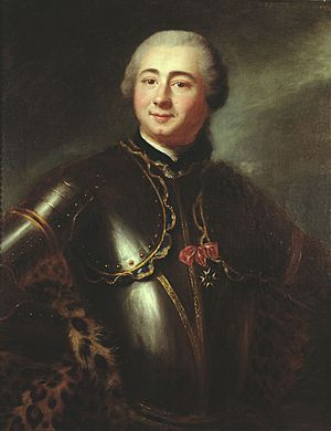
In May 1750, British forces tried to set up a base at Chignecto. But the local leader, Le Loutre, burned the village of Beaubassin. This stopped the British from using its supplies. The British retreated but returned in September 1750.
On September 3, British leaders led over 700 men to Chignecto. Mi’kmaq and Acadians fought against their landing. Twenty British soldiers were killed. The Mi’kmaq killed several of their own. Le Loutre's militia eventually pulled back. They burned the remaining Acadian crops and houses as they left. The British troops won this fight. They began building Fort Lawrence near the ruins of Beaubassin.
To stop the British from expanding, the French also built up their defenses. They built Fort Beauséjour. They also built two smaller forts: Fort Gaspareaux near Port Elgin, New Brunswick and Fort Menagoueche near Saint John, New Brunswick.
During these months, 35 Mi'kmaq and Acadians attacked a group of British rangers. They killed the captain and six of his men. They took seven others captive. The Mi'kmaq tortured the captives. This scared the New Englanders.
The British responded to an attack on Dartmouth in 1751. They sent armed groups to Chignecto. They killed some French defenders. They also broke the dikes, which flooded the low lands. Hundreds of acres of crops were ruined. This was a disaster for the Acadians and French troops. In 1752, Father Le Loutre went to Quebec and France. He raised money and supplies to rebuild the dikes. He returned in the spring of 1753.
Seven Years' War (1756-1763)
On June 3, 1755, a British fleet arrived at Fort Lawrence. It carried 2,100 soldiers from Boston, Massachusetts. They attacked Fort Beauséjour the next day. The French forces left Fort Gaspareaux on June 16, 1755. They chose to move to Fortress Louisbourg instead. This battle was a key victory for the British in the Seven Years' War. Great Britain gained control of all of New France and Acadia.
On the isthmus, the British left Fort Lawrence. They took over the stronger Fort Beauséjour. They renamed it Fort Cumberland. Soon after, the Great Upheaval began. British forces started gathering French settlers. Most of these settlers were sent away. Their villages were burned to stop them from returning.
During the Seven Years' War, there were more conflicts. At Fort Moncton (formerly Fort Gaspareaux), a British soldier was killed in an ambush. British troops searched for the Mi’kmaq but could not find them.

On September 15, British Majors destroyed an Acadian village near Fort Monckton.

On January 20, Boishébert sent a group to Baie Verte. They burned a British ship. They killed seven soldiers and took one prisoner. Boishébert and his 120 Acadians and Mi’kmaq tried to attack Fort Cumberland. But they had to escape a possible ambush.
The Mi'kmaq and Acadians attacked Fort Cumberland on April 26, 1756. Over the next two days, nine British soldiers were killed. When Boishébert moved towards Fort Monckton, the British left it. They burned it down so the French could not use it.
On July 20, 1757, Mi’kmaq captured two British rangers outside Fort Cumberland. On September 6, British forces went to Baie Verte to burn what was left. But when they arrived, the area was already empty.
Yorkshire Emigration
In 1758, Governor Lawrence invited people from New England to Nova Scotia. He offered them free land grants on the empty Acadian lands. He also invited New England soldiers whose service had ended. These settlers became known as the New England Planters.
After the Seven Years' War ended in 1763, the British created three large areas on the isthmus. These were Amherst, Sackville, and Cumberland. They later became part of Cumberland County.
Attracting settlers from New England was not easy at first. So, the British government looked elsewhere. Between 1772 and 1775, over 20 ships arrived from England. They carried more than 1,000 settlers from Yorkshire. The families of these Yorkshire settlers are still important in the area's history today.
American Revolutionary War (1775-1783)
Battle of Fort Cumberland ("Eddy Rebellion")
In October and November 1776, local fighters and American forces tried to take over Fort Cumberland. They were led by Jonathan Eddy and John Allan. Eddy's group included Americans, Mi'kmaq, Acadians, and farmers from the area.
Eddy did not have enough soldiers to attack the fort directly. So, he surrounded it instead. Some local people who supported the rebels burned nearby buildings. After three weeks, British forces arrived from Halifax and Windsor. They defeated the invaders.
The British burned eight of the rebel Acadians' homes and barns. With winter coming, the Acadians had to move their families. Eddy, Allan, and many other English-speaking rebels were also forced to leave Nova Scotia. But the American government rewarded them with land in Maine and Ohio.
|
See also
 In Spanish: Istmo de Chignecto para niños
 | George Robert Carruthers |
 | Patricia Bath |
 | Jan Ernst Matzeliger |
 | Alexander Miles |


