
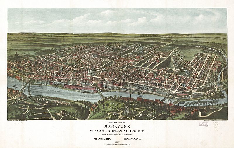
Image: Birds Eye View of Manayunk, Wissahickon, Roxborough from West Laurel Hill Cemetery, Philadelphia, Pennsylvania

Size of this preview: 800 × 506 pixels. Other resolutions: 320 × 203 pixels | 2,288 × 1,448 pixels.
Original image (2,288 × 1,448 pixels, file size: 740 KB, MIME type: image/jpeg)
Description: Map of Manayunk, Wissahickon, and Roxborough neighborhoods in 1907.
Title: Birds Eye View of Manayunk, Wissahickon, Roxborough from West Laurel Hill Cemetery, Philadelphia, Pennsylvania
Credit: Library of Congress Geography and Map Division, http://hdl.loc.gov/loc.gmd/g3824p.pm008020
Author: Fowler, T. M, and Fowler & Kelly
Usage Terms: Public domain
License: Public domain
Attribution Required?: No
Image usage
The following page links to this image:

All content from Kiddle encyclopedia articles (including the article images and facts) can be freely used under Attribution-ShareAlike license, unless stated otherwise.