
Image: Bogoslof April 20 2018

Size of this preview: 790 × 599 pixels. Other resolutions: 316 × 240 pixels | 800 × 607 pixels.
Original image (800 × 607 pixels, file size: 37 KB, MIME type: image/jpeg)
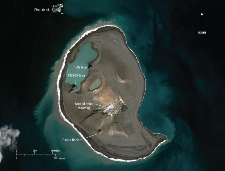
Description: Satellite image of Bogoslof Island taken on April 20, 2018 taken by the Worldview-3 ground imaging satellite.
Title: Bogoslof April 20 2018
Credit: https://www.avo.alaska.edu/images/image.php?id=116891
Author: Chris Waythomas, United States Geological Survey
Usage Terms: Creative Commons Attribution 4.0
License: CC BY 4.0
License Link: https://creativecommons.org/licenses/by/4.0
Attribution Required?: Yes
Image usage
The following page links to this image:

All content from Kiddle encyclopedia articles (including the article images and facts) can be freely used under Attribution-ShareAlike license, unless stated otherwise.