
Image: Borders Chile 1879 and 2006 SP
No higher resolution available.
Borders_Chile_1879_and_2006_SP.png (363 × 526 pixels, file size: 9 KB, MIME type: image/png)
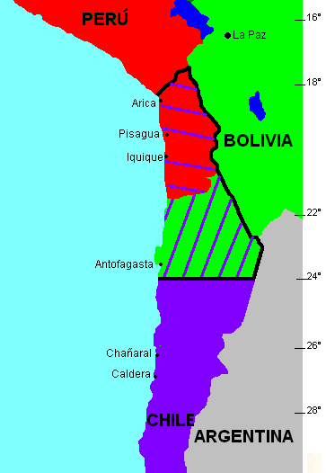
Description: Mapa de las fronteras entre Bolivia, Chile y Perú antes y después de la Guerra del Pacífico de 1879. Versión en español.
Title: Borders Chile 1879 and 2006 SP
Credit: http://commons.wikimedia.org/wiki/Image:Borders_Chile_1879_and_2006.png
Author: User:NL-Ninane (see w:nl:Gebruiker:Ninane)
Permission: original PD
Usage Terms: Public domain
License: Public domain
Attribution Required?: No
Image usage
The following page links to this image:

All content from Kiddle encyclopedia articles (including the article images and facts) can be freely used under Attribution-ShareAlike license, unless stated otherwise.