
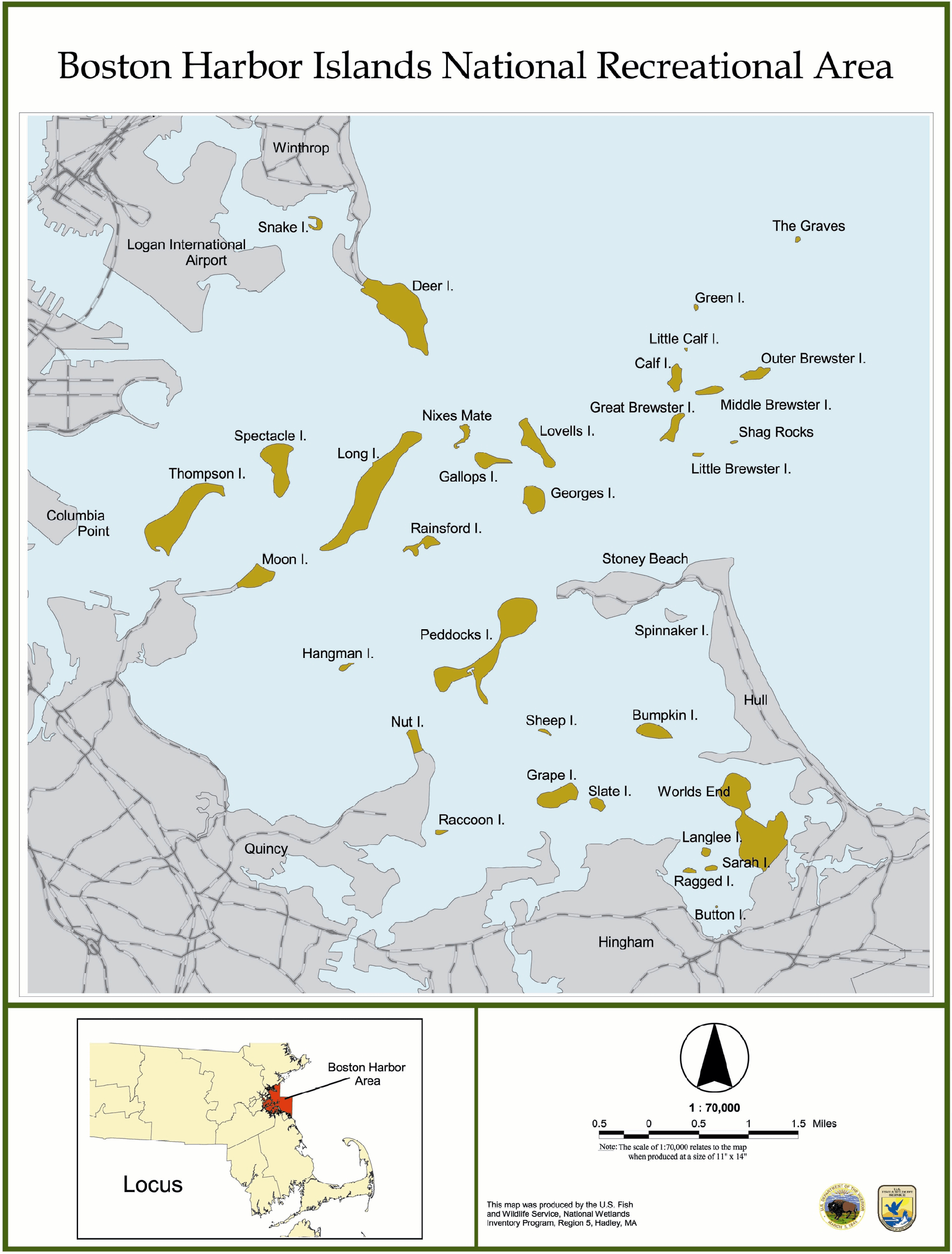
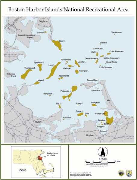
Image: Boston Harbor Islands National Recreation Area
Size of this preview: 455 × 599 pixels. Other resolutions: 182 × 240 pixels | 1,722 × 2,268 pixels.
Original image (1,722 × 2,268 pixels, file size: 1.34 MB, MIME type: image/png)
Description: Map of the Boston Harbor Islands National Recreation Area, Boston, Massachusetts, USA. This image was produced by the United States Fish and Wildlife Service. As a product of the US Government, it is in the public domain and not protected by copyright restrictions. This image was current as of November 2005.
Title: Boston Harbor Islands National Recreation Area
Credit: Scan from the original work
Author: United States Fish and Wildlife Service
Usage Terms: Public domain
License: Public domain
Attribution Required?: No
Image usage
The following 2 pages link to this image:

All content from Kiddle encyclopedia articles (including the article images and facts) can be freely used under Attribution-ShareAlike license, unless stated otherwise.