
Image: Botley Hill trig point - geograph.org.uk - 788400
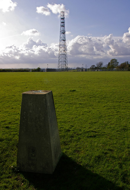
Description: Botley Hill trig point. The highest trig point on the North Downs (benchmark at 266.88m), and until recently most references claimed that this also marked the highest point of the whole of the North Downs. However, in practice, this is not the case. Firstly the land seems to rise slightly to the east, and there is another area slightly to the west which also lies above the 265m contour, with the same 267m spot height (although older maps give the latter point a slightly lower height than the trig point when measured in feet). But more significantly, old 1 inch maps show a spot height of 882 feet next to the water tower in the next square over (see 788446), compared with only 877 feet at the trig point, implying that the true summit point of the North Downs could well be there. This has since been confirmed by surveys. Unfortunately, views to the south at this point are blocked by the woodland of Titsey Plantation, and the nature of the plateau means that the expected view north over London is not available. Behind is one of a number of masts near Botley Hill, this one beside Botley Hill Farm.
Title: Botley Hill trig point - geograph.org.uk - 788400
Credit: From geograph.org.uk
Author: Ian Capper
Usage Terms: Creative Commons Attribution-Share Alike 2.0
License: CC BY-SA 2.0
License Link: https://creativecommons.org/licenses/by-sa/2.0
Attribution Required?: Yes
Image usage
The following page links to this image:
