Botley Hill facts for kids
Quick facts for kids Botley Hill |
|
|---|---|
 |
|
| Highest point | |
| Elevation | 269.6 m (885 ft) |
| Prominence | 209 m (686 ft) |
| Parent peak | Leith Hill |
| Listing | Marilyn |
| Geography | |
| Location | Surrey, England |
| Parent range | North Downs |
| OS grid | TQ387551 |
| Topo map | OS Landranger 187 |
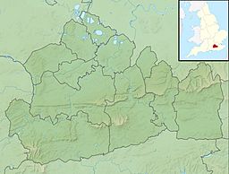
Botley Hill is a special hill located in Surrey, England. It is the highest point of the North Downs, standing at about 269.6 metres (885 ft) tall. An important imaginary line, called the Prime Meridian, crosses right over this hill.
Contents
What Makes Botley Hill Special?
Botley Hill is known for a few cool reasons. It's a "Marilyn," which is a type of hill. To be a Marilyn, a hill must rise at least 150 meters (about 492 feet) above the land around it. Botley Hill is the third highest point in Surrey. Only Leith Hill and Gibbet Hill are taller. These other two hills are found on the Greensand Ridge.
A Historic Survey Point
Long ago, from 1784 to 1790, Botley Hill was a key spot for a big science project. This project was called the Anglo-French Survey. Its goal was to precisely measure the distance between two famous observatories. These were the Royal Greenwich Observatory in England and the Paris Observatory in France. General William Roy led this important task.
The Prime Meridian
It's a cool coincidence that the Prime Meridian crosses Botley Hill. The Prime Meridian is an imaginary line that runs from the North Pole to the South Pole. It marks 0 degrees longitude on Earth's maps. This line passes just west of the hill's very top.
Finding the Top of Botley Hill
The highest point of Botley Hill is near a water tower. This tower is located north of a road called The Ridge. The summit is less than 1 kilometer (about half a mile) from the North Downs Way. The North Downs Way is a popular walking path.
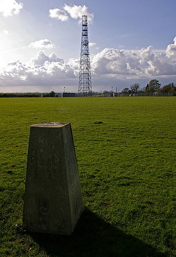
For a long time, people thought the highest point was a different spot. This was a "trig point" at 267 meters (876 feet). A trig point is a special marker used for surveying. However, a detailed survey later confirmed the water tower area is actually the highest. The closest train station to Botley Hill is in Oxted, to the south.
Amazing Views from Botley Hill
From the top of Botley Hill, you can see far and wide! On a clear day, you might spot the tallest buildings in Croydon. You can even see skyscrapers in London. Other places visible include Alexandra Palace, Stanmore Hill, Primrose Hill, Highgate, and Hampstead. These places are on the other side of the Thames Basin.
 | Georgia Louise Harris Brown |
 | Julian Abele |
 | Norma Merrick Sklarek |
 | William Sidney Pittman |


