
Image: Boundary Stone on the Thames Path - geograph.org.uk - 950999
No higher resolution available.
Boundary_Stone_on_the_Thames_Path_-_geograph.org.uk_-_950999.jpg (640 × 362 pixels, file size: 68 KB, MIME type: image/jpeg)
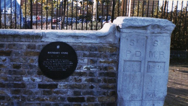
Description: Boundary Stone on the Thames Path The caption reads "This stone marks the boundary between St Mary's parish, Rotherhithe and St Paul's parish, Deptford. Until 1899 this was also the Kent-Surrey boundary. The stone was on a bridge over the Earl Creek nearby, but was relocated here in 1988."
Title: Boundary Stone on the Thames Path - geograph.org.uk - 950999
Credit: From geograph.org.uk
Author: Shazz
Usage Terms: Creative Commons Attribution-Share Alike 2.0
License: CC BY-SA 2.0
License Link: https://creativecommons.org/licenses/by-sa/2.0
Attribution Required?: Yes
Image usage
The following page links to this image:

All content from Kiddle encyclopedia articles (including the article images and facts) can be freely used under Attribution-ShareAlike license, unless stated otherwise.