
Image: Bretagne region location map

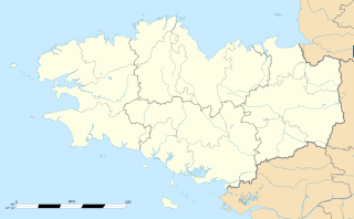
Description: Blank administrative map of the region of Bretagne, France, for geo-location purpose, with distinct boundaries for regions, departments and arrondissements.
Title: Bretagne region location map
Credit: Own work Shores : NASA Shuttle Radar Topography Mission (SWBD) (public domain) ; Additional reference for confirmation: Géoportail.
Author: Eric Gaba (Sting - fr:Sting)
Permission: Attribution and Share-Alike required Any use of this map can be made as long as you credit me (Eric Gaba – Wikimedia Commons user: Sting) as the author and distribute the copies and derivative works under the same license(s) that the one(s) stated below. A message with a reply address would also be greatly appreciated.
Usage Terms: Creative Commons Attribution-Share Alike 3.0
License: CC BY-SA 3.0
License Link: http://creativecommons.org/licenses/by-sa/3.0
Attribution Required?: Yes
Image usage
More than 100 pages link to this image. The following list shows the first 100 page links to this image only. A full list is available.
- Baden, Morbihan
- Bannalec
- Berhet
- Berrien, Finistère
- Beuzec-Cap-Sizun
- Bobital
- Bohars
- Bolazec
- Bourseul
- Brignogan-Plages
- Cancale
- Carantec
- Collorec
- Edern, Finistère
- Elliant
- Gouézec
- Guiler-sur-Goyen
- Guilers
- Guissény
- Henvic
- Irvillac
- Kerlaz
- Kernouës
- La Forest-Landerneau
- La Forêt-Fouesnant
- La Roche-Maurice
- Lampaul-Ploudalmézeau
- Landeleau
- Landudec
- Lannédern
- Le Bodéo
- Le Cloître-Saint-Thégonnec
- Le Faou
- Le Folgoët
- Le Trévoux
- Lennon, Finistère
- Loc-Eguiner
- Loc-Eguiner-Saint-Thégonnec
- Locmaria-Plouzané
- Locquirec
- Locunolé
- Lorient
- Lothey
- Mahalon
- Morlaix
- Moëlan-sur-Mer
- Névez
- Paimpol
- Pencran
- Perros-Guirec
- Pleyber-Christ
- Plobannalec-Lesconil
- Plogastel-Saint-Germain
- Plonéour-Lanvern
- Plonévez-du-Faou
- Ploudalmézeau
- Plouezoc'h
- Plougar
- Plougoulm
- Plougourvest
- Plouguin
- Plouigneau
- Plounéour-Brignogan-Plages
- Plounéour-Trez
- Plourin-lès-Morlaix
- Plouvien
- Plouvorn
- Plouyé
- Plouzévédé
- Plouégat-Moysan
- Plouénan
- Port-Launay
- Poullan-sur-Mer
- Poullaouen
- Quimper
- Quintin
- Quéménéven
- Riec-sur-Belon
- Roscanvel
- Roscoff
- Rostrenen
- Rédené
- Saint-Brieuc
- Saint-Derrien
- Saint-Hernin
- Saint-Nic
- Saint-Thégonnec Loc-Eguiner
- Saint-Urbain, Finistère
- Saint-Vougay
- Saint-Évarzec
- Sainte-Sève
- Trébeurden
- Tréflaouénan
- Tréglonou
- Trégourez
- Tréméven, Finistère
- Tréogat
- Tréouergat
- Ushant
- Vannes
