
Image: Bridge Inn, Cinderford, Forest of Dean - geograph.org.uk - 1041689
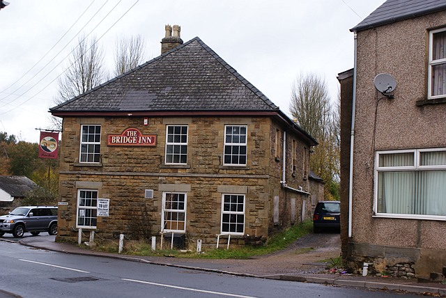
Description: Bridge Inn, Cinderford, Forest of Dean The Bridge Inn stands on the corner of Saint White's road and Valley road at the very South Western corner of Cinderford. It has now closed as an Inn or public house. The alley-like gravelled lane to the right of the Inn was a tram road, sometimes called locally a Dram Road. The roof, it is of a type called 'hipped, signifies that it is an important building - the only other one nearby is that of the one-time Mine Manager which still stands on a little knoll to the North East of the Bridge Inn.
Title: Bridge Inn, Cinderford, Forest of Dean - geograph.org.uk - 1041689
Credit: From geograph.org.uk
Author: Eric Soons
Usage Terms: Creative Commons Attribution-Share Alike 2.0
License: CC BY-SA 2.0
License Link: http://creativecommons.org/licenses/by-sa/2.0
Attribution Required?: Yes
Image usage
The following page links to this image:
