
Image: C77198s1 Ant.Map Taylor Glacier
Size of this preview: 795 × 600 pixels. Other resolutions: 318 × 240 pixels | 4,312 × 3,252 pixels.
Original image (4,312 × 3,252 pixels, file size: 1.45 MB, MIME type: image/jpeg)
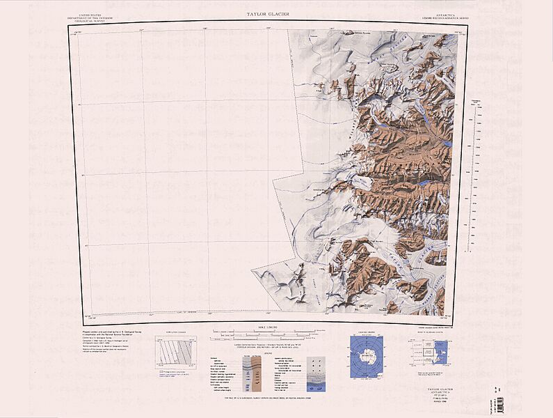
Description: 1:250,000-scale topographic reconnaissance map of the Taylor Glacier area from 156°-162'E to 77°-78°S in Antarctica. Mapped, edited and published by the U.S. Geological Survey in cooperation with the National Science Foundation.
Usage Terms: Public domain
Image usage
The following page links to this image:

All content from Kiddle encyclopedia articles (including the article images and facts) can be freely used under Attribution-ShareAlike license, unless stated otherwise.